The week ahead: Back to school…and storms
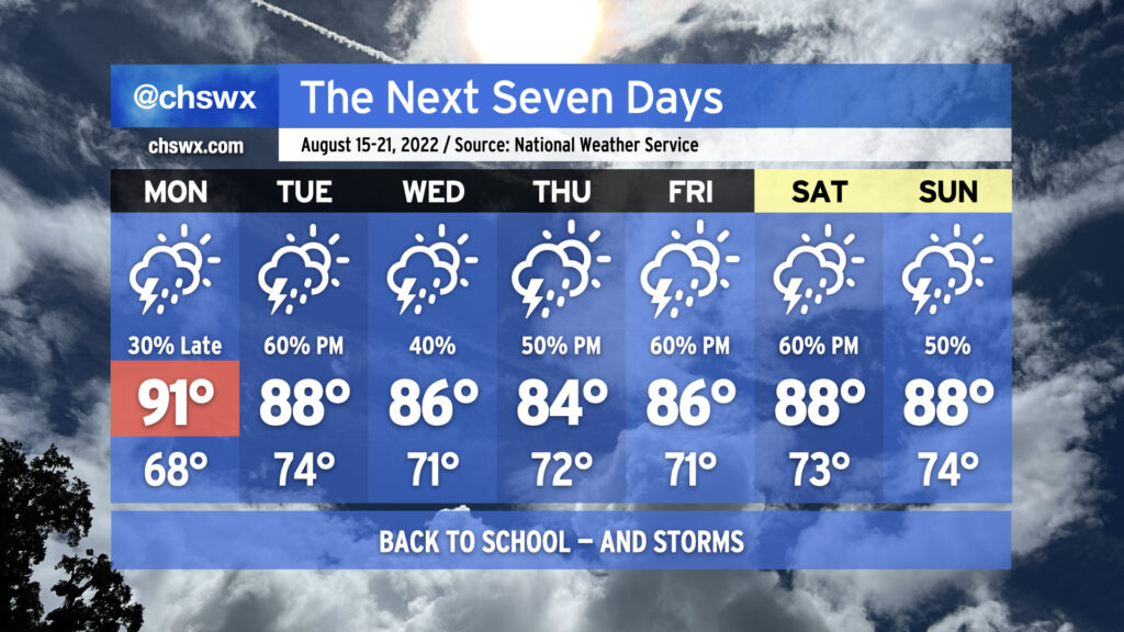
After a weekend in which we felt the lowest dewpoints in almost two months, more moisture will begin to work back into the area as another front drives into the area and stalls out, leading to an unsettled back-to-school week across the Lowcountry.
We’ve got one more cool start to the day on Monday as lows bottom out in the mid-to-upper 60s away from the coast, but that’ll quickly give way to low 90s in the afternoon. Much of the day remains dry, but we’ll want to keep an eye on what takes place to our northwest as the aforementioned front, along with some upper-level help, drives a cluster of showers and thunderstorms through the western Carolinas during the day. It’s possible that it could hold together to bring us some showers and maybe a thunderstorm or two in the late evening as it migrates southeastward. A few storms could be severe especially along and west of I-95, too. It’s not a slam dunk, but certainly worth watching.
Rain becomes more likely heading into Tuesday as the front arrives and stalls out. A wave of low pressure along the front should enhance shower and thunderstorm chances for the afternoon. There will be plenty of moisture to wring out a fair bit of rain out of the heaviest storms, so we’ll be watching closely for the potential for localized flooding concerns. This setup continues through the rest of the week as the front will continue to meander around the area, occasionally with a wave of low pressure traversing it to help enhance those rain chances a bit more at times. (Stay tuned for day-to-day adjustments to these — stalled fronts are fickle beasts.) Temperatures will generally run in the mid-to-upper 80s in the afternoons, tempered by rain chances and cloud cover.