The week ahead: Wet pattern continues
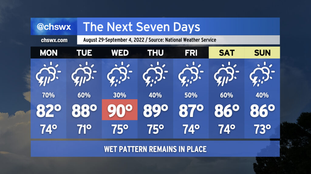
More wet weather is on the way as we remain in a rather unsettled pattern heading into the first days of September (and meteorological fall!)
We’ll likely start Monday with showers and maybe some thunderstorms in the metro area as offshore storms make a run to the coast. Be ready for a somewhat complicated commute due to rain. It’ll be worth watching downtown around high tide just before 10am, too, for the potential for heavy rain to combine with said tide to possibly produce some street flooding. Storms and their associated pockets of heavy rain will continue to spread inland throughout the day. Rain and cloud cover will keep temperatures suppressed to the low 80s.
We stay unsettled heading into Tuesday as a front moves toward the area. Thunderstorms will become likely once again in the afternoon, though temperatures will have a little more time to rebound into the upper 80s. Expect more scattered coverage Wednesday as a little drier air aloft moves in, which will allow temperatures to head into the low 90s in the afternoon ahead of the front. The front moves by Thursday and stalls out to the south, which will help keep moisture in place and the risk for showers and thunderstorms in the forecast as we head into the Labor Day weekend. As is customary for late summer, there will not be any day that’s a total washout — just have backup plans for any outdoorsy things you might have going on.
Tropics are heating up
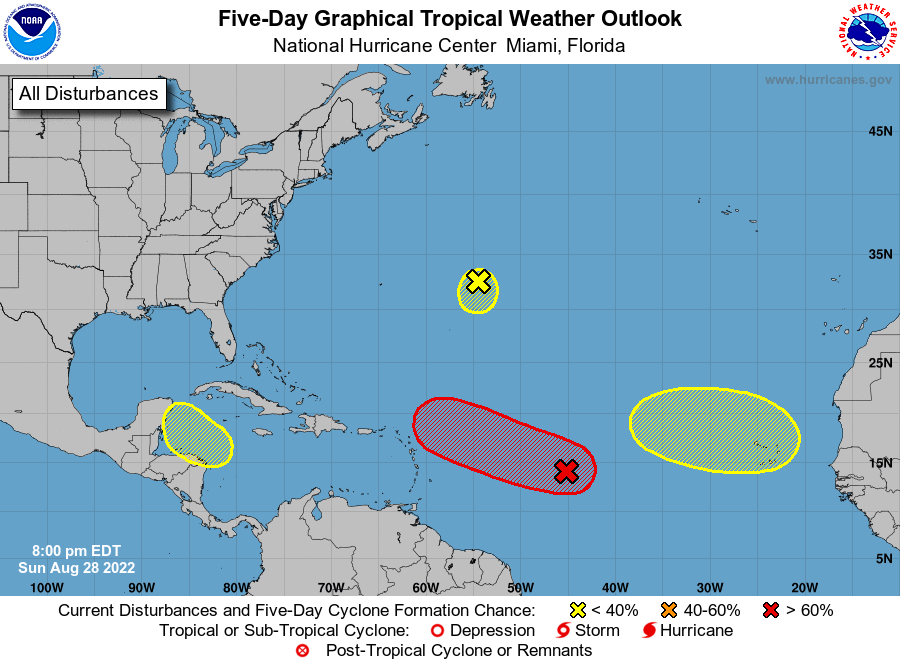
It’s been a hot minute since we’ve had to think about the tropics — there’s not been a named tropical cyclone since Colin dissipated on July 3rd, and Potential Tropical Cyclone Four never fully organized before coming ashore in Mexico. This should change this week, though, as a disturbance moving across the Atlantic has a 70% chance of developing in the next five days as it approaches the Lesser Antilles. It’s tough to know many more details beyond that right now — as one would expect, model guidance diverges pretty sharply beyond mid-week. For now, there’s no imminent threat to the Carolinas. Regardless, it’s a good reminder that we are in the heart of the tropical season, and that it’s important to have your hurricane plan in good shape by this point in the year as things can develop quickly. Stay tuned…