Tuesday: Sweater weather returns
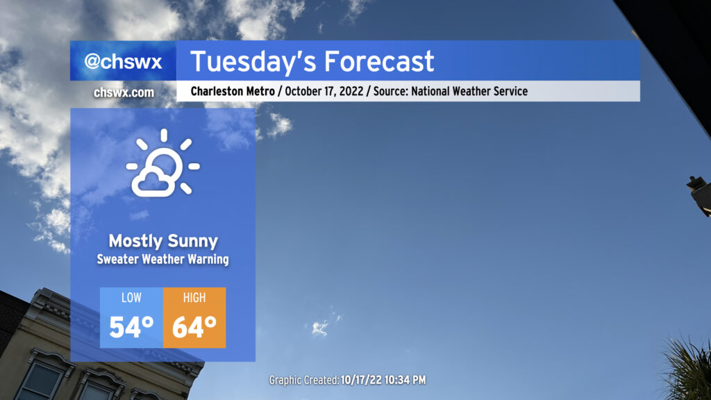
A cold front will move through overnight, ushering in the first really solid chill of the season for the Lowcountry. Morning lows will bottom out in the mid-50s, while cold advection within a northwesterly breeze will only allow temperatures to rise to the mid-60s in the afternoon despite almost full sunshine. These high temperatures will run some 10-15° below normal for this point in October, matching the very cool high temperatures we experienced during Hurricane Ian at the end of September (minus the hurricane part).
Rest of the work week: Well-below normal temperatures continue
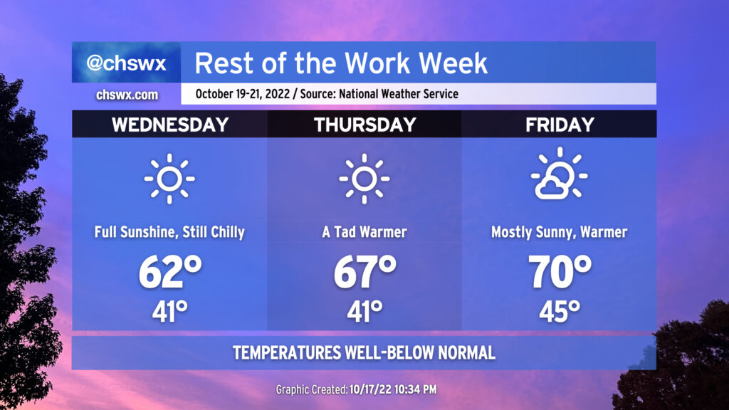
You’ll be forgiven if you suddenly have a panic over unfinished Christmas shopping when you step outside on Wednesday: temperatures that day will feel more like mid-December than mid-October despite unfettered sunshine. Thursday will feel similar, especially in the morning, though we’ll run only ten degrees below normal in the afternoon as opposed to 15° below normal the day before. Lows in the 40s persist into Friday, but highs should once again reach 70° in the afternoon with just a couple clouds at times as the airmass begins to modify a bit heading into the weekend.