Frosty start to Thursday, but a warming trend follows
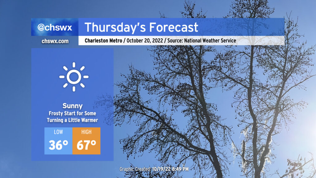
Some of us are going to get off to a frosty start on Thursday as temperatures fall into the mid-30s overnight, perhaps threatening the record low of 34° set in 1981. A Frost Advisory will be in effect from 4-9am for inland Berkeley and Dorchester counties as this is where temperatures are most likely going to be low enough to support frost formation. I don’t know that I could totally rule some patchy frost out a little further eastward as well in more sheltered spots. Bring in plants and pets tonight to be safe.
From there, full sunshine will begin to modify the chilly airmass that’s been in place over the past couple days. Highs Thursday afternoon will still run well below climatology for this point in October, but will be a few degrees warmer than we felt Wednesday, topping out in the mid-to-upper 60s. (More on Wednesday’s temperatures in a sec.)
Friday & the weekend: Warming trend
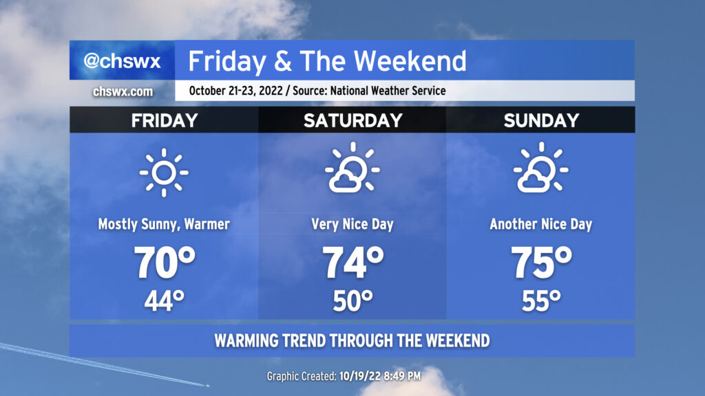
Temperatures will continue to warm across the area as we head into the weekend. We should top out around 70° on Friday with highs peaking in the mid-70s Saturday and Sunday. Low temperatures will moderate quite nicely as well; mid-40s lows on Friday will be followed by low 50s Saturday and mid-50s on Sunday. Rain-free conditions will continue, but we will see a few clouds from time to time. Beyond the weekend, upper 70s highs return starting Monday through at least mid-week next week.
Record cool temperatures on Wednesday
Wednesday morning’s low of 37° set a new record low temperature for October 19, breaking the record of 39° set in 1948. Additionally, the high of 62° ties the record low maximum temperature for the date, first set in 1948 and tied again in 1974.
Thursday’s record low of 34° set in 1981 could be within striking distance (though is not explicitly forecast to be broken). The record low maximum of 56°, set in 1989, will remain safe with highs expected to top out well into the 60s.