Friday & the weekend: Seasonably cool under the wedge
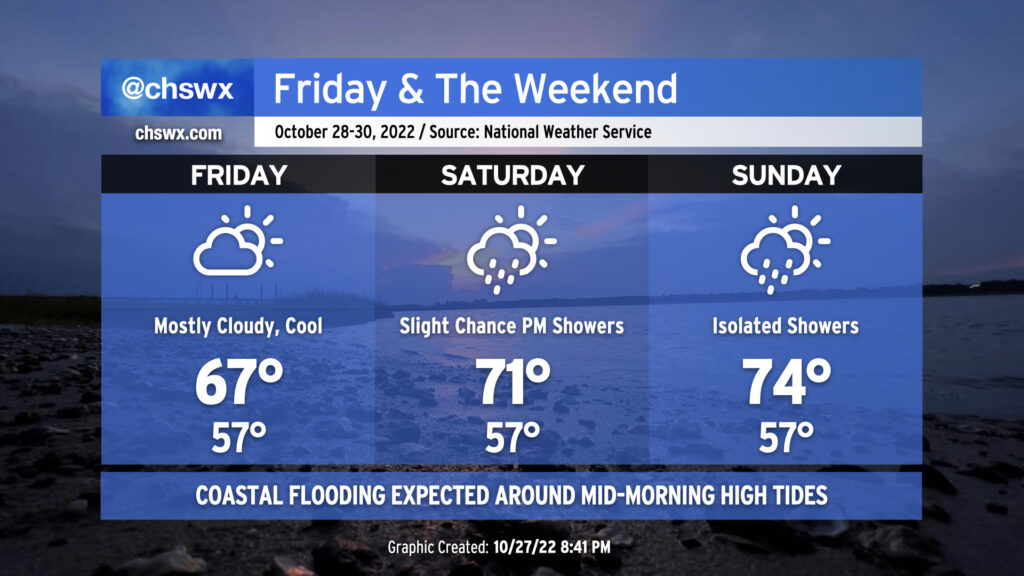
High pressure wedging into the area will keep clouds and cool temperatures around for Friday into the weekend. Temperatures shouldn’t get out of the 60s on Friday with a steady northeasterly breeze and mostly cloudy skies thanks to a thin layer of moisture being lifted atop the wedge. We could see a couple more breaks in the clouds on Saturday — along with a shower or two — as highs should creep above 70°. (Beware the wedge and its uncanny ability to bust temperature forecasts, though.) A warm front will sharpen and lift through the area on Sunday ahead of a cold front on Monday; this will help highs recover to the mid-70s in the afternoon. Moisture remains very shallow, but a shower or two can’t be totally ruled out in the evening hours.
The main weather hazard will continue to be coastal flooding thanks to continued astronomical influences from the lunar perigee and northeasterly winds. Friday morning’s high tide is expected to peak between 7.6-7.8′ in the harbor around 10:37am, which will be high enough to cause scattered road closures in downtown Charleston, particularly around the edges of the peninsula, a few hours on either side of that tide. Similar conditions are expected with Saturday morning’s high tide, forecast to peak a little after 11:30am. Water levels are expected to run a touch lower with the midday Sunday high tide, but should still be plenty high enough to produce minor to moderate coastal flooding, once again likely closing some roads. The good news is that any rain that falls won’t be very heavy at all, and won’t be enough to exacerbate any ongoing flooding.