Turning cooler Thursday through the weekend
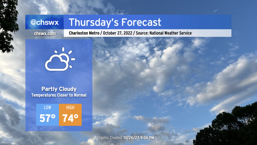
A cold front is on its way through this evening, which will bring cooler temperatures for Thursday and beyond after highs peaked in the low 80s this afternoon away from the locally cooler coastline. Winds will go to the north and then the northeast overnight as high pressure builds in from the north and west. We’ll generally see scattered clouds throughout the day with those northeast winds keeping us about 5-7° cooler than we saw Wednesday. The aforementioned northeasterly winds and upcoming lunar perigee will contribute to another risk for minor to moderate coastal flooding around the 9:47am high tide, so be aware of the potential for closed roads once again tomorrow morning (though the peak of any tidal flooding should miss the bulk of any commute time at this point).
Friday & the weekend: High pressure wedge develops, with showers possible at times
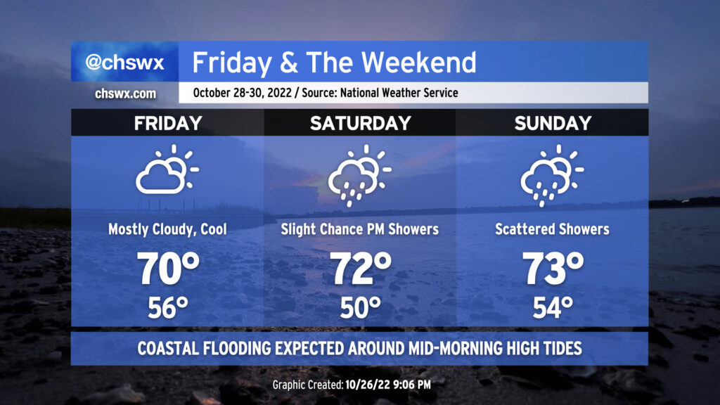
As is common in the cool season, high pressure will wedge southwestward between the warmer Atlantic and the Appalachians starting on Friday. This will help trap a little moisture and cause increased cloud cover, which should act to suppress high temperatures on Friday to around 70°. This pattern stays in place through the weekend with temperatures continuing to run a few clicks below normal through Sunday. As moisture influx increases thanks to low pressure moving inland from the Gulf well to the west, slight shower chances begin Saturday afternoon and run through Sunday. No washout is expected, nor will it be completely gray either, but be prepared for a light rain at times.
Coastal flooding concerns peak Friday
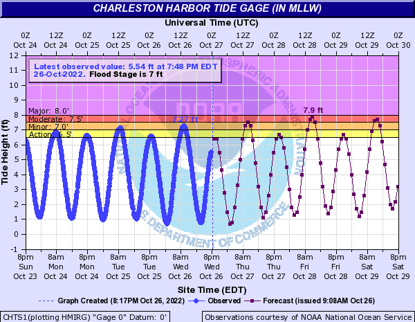
Coastal flooding concerns will continue through the weekend, peaking Friday along with the lunar perigee. Minor to moderate flooding is expected with the 9:40am high tide Thursday, while moderate to major flooding is forecast a few hours either side of Friday morning’s 10:37am high tide. Water levels late Saturday morning should fall solidly in the moderate coastal flooding category, potentially causing disruptions to travel around lunchtime. Guidance suggests minor to moderate coastal flooding will remain possible with high tide a little after noon on Sunday as well. Any rain that falls should not be heavy enough to add to any flooding issues, which is some good news.
Stay alert for Coastal Flood Advisories from the National Weather Service through this weekend. Be sure to use alternate routes if you encounter flooded roads — the salt water is no good for your car.