Weekend forecast: A few showers at times but no washout; coastal flood risk continues
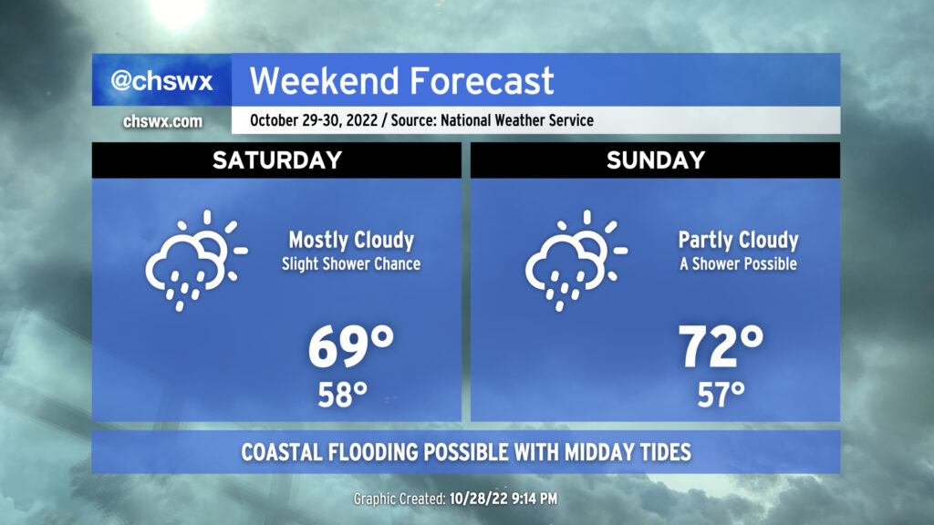
The weekend forecast will generally run on the cool side, particularly on Saturday, with a few showers possible at times. High pressure remains wedged into the area, and moisture trapped beneath the wedge inversion aloft will keep cloud cover and a few light showers in the forecast. Much like Friday, highs will likely not exceed 70° with the lack of insolation and cool northeasterly winds continuing to reinforce the wedge.
We should see a little bit more sunshine — and a little more warmth as a result — on Sunday as the wedge begins to erode. Still, a few showers will be possible at times, and one should not 100% trust the wedge to erode when it is supposed to.
Overall, you’ll want to have a hoodie or light jacket both days, and be ready to evade a few light showers, but it won’t be enough to cause major problems.
Coastal flooding issues to continue this weekend
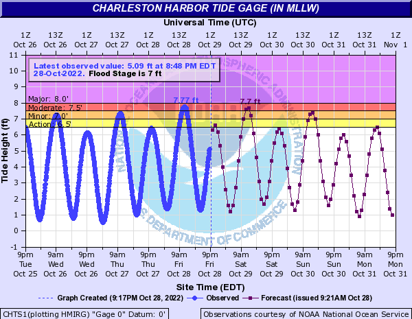
The persistent northeasterly wind and continued astronomical influences will contribute to a couple more rounds of coastal flooding with the midday high tides this weekend. Much like the Friday morning high tide, Saturday’s 11:30am-ish high tide should top out between 7.6-7.8′. This will close a few roads in downtown Charleston around the lunch hour, so be ready to use alternate routes as needed.
Tides will run a little lower midday Sunday, but minor to moderate coastal flooding is still a possibility, with a few road closures in the offing. Once again, be ready to use alternate routes a couple hours either side of high tide.
Flooding isn’t explicitly forecast for Monday as of yet, but guidance suggests that minor coastal flooding could be possible with the early afternoon high tide. We’ll keep an eye on that. Overall, though, the risk will decrease as next week rolls on.