Meteorological winter begins on a cool note Thursday, but warming follows

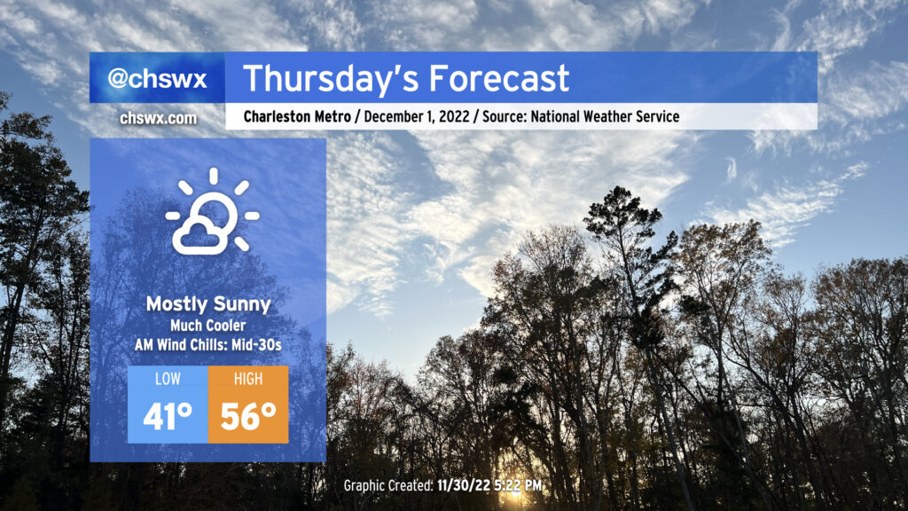
A cold front will swing through tonight, ushering in a cooler and drier airmass for Thursday. We’ll start the day in the low 40s, but gusty post-frontal winds will make it feel closer to 35°. Cold advection will keep afternoon high temperatures pinned into the mid-50s at best despite nearly full sunshine. A few clouds will develop late as a coastal trough begins to take shape, but other than that, expect a rather bright Thursday.
Friday & the weekend: Cloudiness returns, but turning warmer

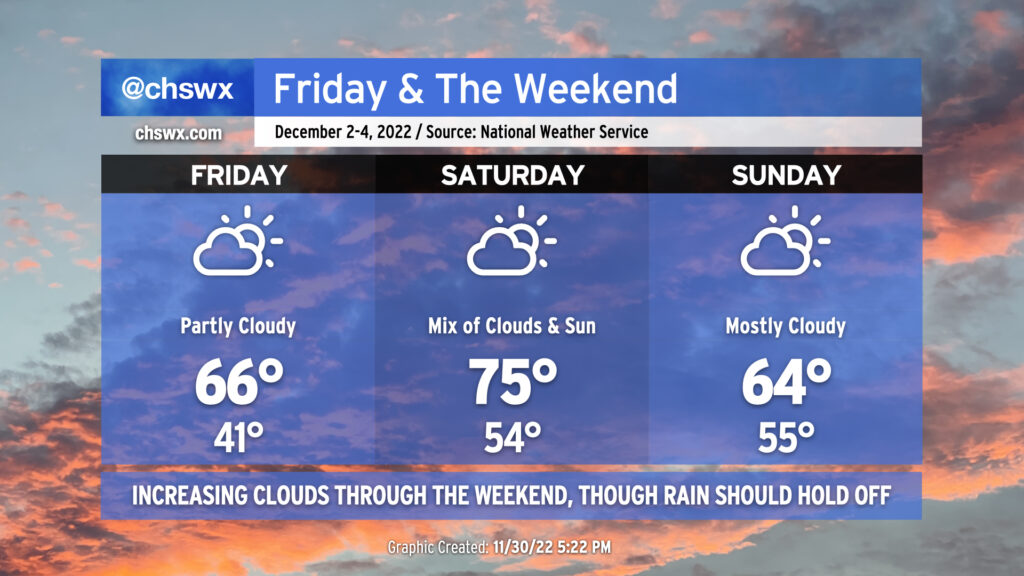
As the aforementioned coastal trough hangs out, we’ll see a gradual increase in cloud cover through the weekend. However, temperatures will be on the rebound: mid-60s are expected Friday, while highs should peak in the mid-70s on Saturday. Rain-free conditions are expected both days.
Sunday is a bit of an enigma. Models have trended further south with a cold front on Sunday, which would help keep temperatures a little more suppressed into the mid-60s depending on how far south it ultimately ends up. There’s a chance it stays a little more north, which would help temperatures stay a little on the warmer side, but for now, the thinking is that the front gets just south of here and socks us in with cloud cover and mid-60s. Again, though, no rain is expected through Sunday, though some showers could develop late Sunday night into Monday. Stay tuned for fine-tuning.
Hurricane season is over

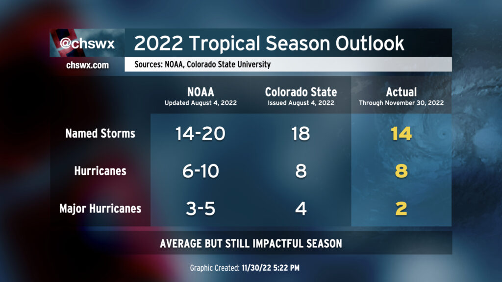
Mercifully, November 30 marks the end of hurricane season in the Atlantic basin. While the number of storms was generally on the low end of what was predicted, it was still a fairly busy season at times, especially for those who took the full hit from Ian in Florida. Here at home, we got quite a soaking from what would eventually be classified as Colin, followed by a decent lashing from Hurricane Ian and some annoyance (with a couple nocturnal tornado warnings) from Tropical Storm Nicole.
So until next summer, that’s it for hurricane coverage (barring something bizarre…which, you never know, because 2022). Until then, thank you for following along during our brushes with tropical mischief.
Follow my Charleston Weather updates on Mastodon, Bluesky, Instagram, Facebook, or directly in a feed reader. Do you like what you see here? Please consider supporting my independent, hype-averse weather journalism and become a supporter on Patreon for a broader look at all things #chswx!