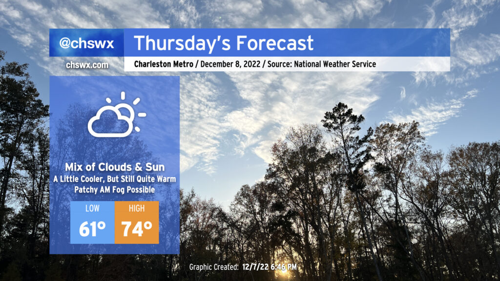
Thursday: A little cooler, but still quite warm

After tying a record high on Wednesday (81°!), we’ll see a cold front approach our area for Thursday. The associated cloud cover will help prevent us from getting back to record warmth, but we’ll still see highs peak in the mid-70s — perhaps higher if the front struggles to get further south. We should remain rain-free, however.

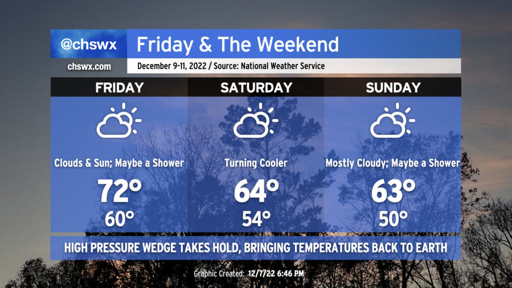
Temperatures will come back to earth this weekend as the front finally makes a surge southward on Friday and high pressure fully wedges into the area from the north. Highs on Friday will run in the low 70s with maybe a shower in the afternoon as the front lingers in the area. Saturday turns cooler but still fairly cloudy with highs topping out in the low-to-mid-60s — right where we should be for December 10. Temperatures stay near normal for Sunday with mostly cloudy skies continuing. A shower or two may be possible with moisture overrunning the wedge as low pressure shifts eastward across the Southeast, but right now it looks more dry than not. As always, stay tuned for any forecast tweaks that end up being required.
Also of note: The recent full moon and winds going around to the northeast with the high pressure wedge setting in will get us awfully close to coastal flooding thresholds with Friday and Saturday morning’s high tides (at least). The next coastal flooding event be our 69th of the year, passing 2020’s 68 events for second-most on record. (The busiest coastal flooding year on record was 2019, with a mind-boggling 89 events [water levels greater than 7′ mean lower low water in Charleston Harbor].)
Follow my Charleston Weather updates on Mastodon, Bluesky, Instagram, Facebook, or directly in a feed reader. Do you like what you see here? Please consider supporting my independent, hype-averse weather journalism and become a supporter on Patreon for a broader look at all things #chswx!