Thursday: Stormy, especially early, then cooler air settles in
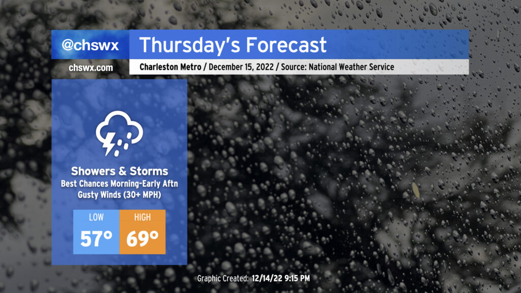
A warm front is lifting north across Georgia and South Carolina this evening, which will make for a warmer and more muggy day for Thursday ahead of a cold front. I’d anticipate that the forecast morning low of 57° will be set closer to midnight, followed by temperatures heading into the 60s by daybreak, topping out around 70° in the afternoon. Gusty winds will precede the front even outside of any thunderstorms — watch for gusts 30-35 MPH to potentially cause some havoc with Christmas decorations. We can expect a few showers and maybe even a thunderstorm or two overnight into the morning ahead of the main frontal band.
The timing of the front and the extent of morning shower activity will act as a governor on any severe weather threat that could develop. Shear looks good, but instability is the question mark. Still, a few storms with gusty straight-line winds are possible, and there’s even the risk for a few of these storms to rotate. Keep an eye on the weather Thursday, particularly mid-morning through early afternoon, for any possible watches or warnings that might need to be issued.
We should be rid of the rain by evening — some of the faster guidance coming in this evening even has it out of here by mid-afternoon, with some sunshine breaking out before the day’s over — with temperatures falling into the 50s by 8 PM as cooler and drier air moves in behind the cold front.
Friday and the weekend: Cool, then colder
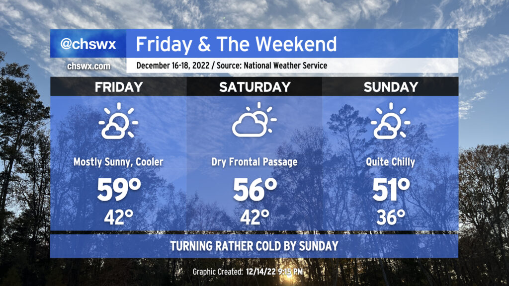
We’ll have much more in the way of sunshine on Friday in the wake of the front. Temperatures will start out right around normal for this point in the year, with lows bottoming out in the low 40s in the metro area. Cool air moving into the area will keep highs in the upper 50s to around 60 despite nearly uninterrupted sunshine.
Saturday turns a little cloudier as a reinforcing cold front moves by. The increasing cloud cover will keep highs from getting much out of the mid-50s after another start in the low 40s. Beyond that, though, this frontal passage looks rain-free given dry air already in place.
We will definitely feel the after-effects of the aforementioned cold front on Sunday. Lows will bottom out in the mid-30s (with cooler temperatures possible in more rural areas). The Arctic shot of cool air will limit high temperatures to around 50-51° despite lots of sunshine. Get used to this, as the pattern favors cooler-than-normal temperatures perhaps through the end of the year!
Follow my Charleston Weather updates on Mastodon, Bluesky, Instagram, Facebook, or directly in a feed reader. Do you like what you see here? Please consider supporting my independent, hype-averse weather journalism and become a supporter on Patreon for a broader look at all things #chswx!