Rest of the work week: Warming trend continues
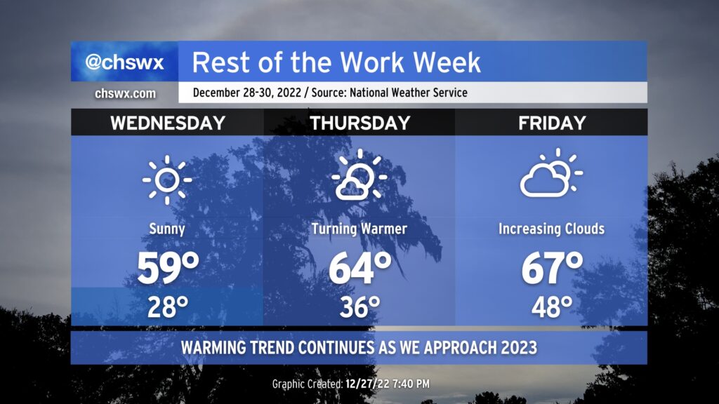
We will continue to trend warmer heading toward New Year’s Weekend. First, though, we’ve got to get through one more night of subfreezing temperatures, and then we get a long break. But once again tonight, though, be sure to have a faucet dripping, pipes insulated, pets indoors, plants covered, and the people in your life accounted for and warm. Temperatures will bottom out in the upper 20s — certainly not as severe of a freeze as we have seen recently — across the metro area. The good news is that we’ll warm nicely with temperatures approaching 60° in the afternoon under brilliantly sunny skies.
This warming trend continues for Thursday and Friday. While we start Thursday in the mid-30s, we won’t get below freezing (and won’t for a while). Expect afternoon highs in the mid-60s with just a few clouds.
Clouds will be on the increase ahead of a storm system on Friday, but we’ll still get a decent amount of sunshine in. Morning lows will be noticeably warmer, perhaps not getting below 50° at the coast and bottoming out in the upper 40s everywhere else. Highs will once again peak in the mid-60s, perhaps with some upper 60s in some spots.
Looking ahead to New Year’s Weekend
New Year’s Eve plans should factor in the risk for some showers and maybe even a thunderstorm or two, unfortunately. While temperatures will be relatively warm — expect low 60s as the clock strikes midnight — you’ll want rain gear if you’re out and about roughly midday Saturday into Sunday.