Rest of the work week: Unsettled Wednesday, then cooling off
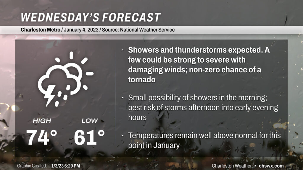
Wednesday will be another mild day, with temperatures running in the mid-70s ahead of a storm system which will turn the afternoon and evening hours unsettled with the risk of a strong storm or two.
Showers and thunderstorms ongoing in Georgia as of this writing are expected to weaken before arriving in our nook of the Lowcountry, though a shower or two may not be completely off the table Wednesday morning particularly near I-95. It will be a mild overnight and morning, with lows only bottoming out in the low 60s. The record low minimum temperature for January 4 is 63°; this record, set in 2015, could be in jeopardy. Fog potential is somewhat lower than last night away from the coast, but sea fog may continue to have impacts on coastal communities throughout the night into tomorrow. Be ready for sudden drops in visibility.
Rain chances head up in the afternoon and evening hours as a line of showers and thunderstorms is forecast to move through the Southeast toward the coast throughout the day, and enough instability and shear should overlap to perhaps bring a stronger storm or two with damaging wind gusts the main concern as of right now. A tornado on the leading edge of the line can’t be totally ruled out, either, particularly inland of I-95. As storms move toward the coast and marine-cooled air (temperatures running closer to 60° than mid-70s), they should become elevated and lose some punch. Still, it’ll be worth watching the line as it moves east, and you’ll want to keep an ear out for possible warnings in the evening.
Rest of the work week: After Wednesday storms, clearing out and cooling off
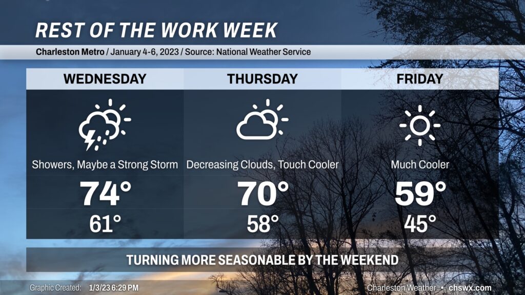
Once storms clear the area Wednesday, we’ll begin to clear out and cool off. The cooler air behind the front will lag the storms by about 12 hours or so, allowing highs to once again reach 70° on Thursday after starting in the upper 50s. Skies will gradually become predominantly clear as we head into Friday morning, which will feel closer to a January day than not with lows in the mid-40s. Highs on Friday will struggle to 60° despite full sunshine in the afternoon, which is much more representative of this time of year as opposed to what we’ve experienced the past few days. Quiet weather looks to last into the weekend as the airmass moderates; we’ll be back in the mid-60s by Sunday. No freezing temperatures are expected with this round of cool air, by the way…welcome news for a busted-pipe-weary public and utilities.
Follow my Charleston Weather updates on Mastodon, Bluesky, Instagram, Facebook, or directly in a feed reader. Do you like what you see here? Please consider supporting my independent, hype-averse weather journalism and become a supporter on Patreon for a broader look at all things #chswx!