Wednesday: Windy with showers and maybe a couple strong storms later in the day
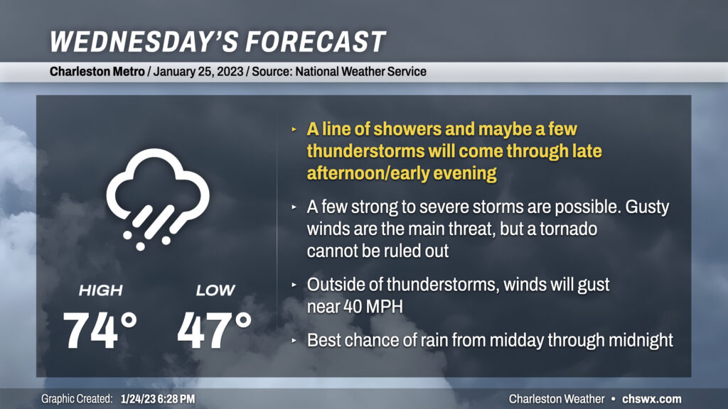
Wednesday could be a busy weather day here in the Lowcountry as a very dynamic storm system moves into the eastern half of the continental US, dragging a cold front through the Southeast throughout the day with showers and thunderstorms ahead of it.
Temperatures on Wednesday will rocket into the mid-70s as warm air surges into the area from the south. That warm wind will be on the strong side, too: expect gusts 35 to perhaps 40 MPH across the area to start kicking up a couple hours after sunrise. This could make for some difficult bridge travel, so be sure to take it a little slower tomorrow if the bridges are in your travel plans.
Shower chances will be increasing throughout the day, culminating in a squall line running ahead of the front that looks timed to come through in the late afternoon through early evening hours. (Stay tuned for timing tweaks.) Rain with this line could be on the heavy side at times, but the storms will be moving pretty fast and so flooding doesn’t seem to be a major concern.
The thing to watch tomorrow will be the potential for some severe weather as the band of storms moves across the area. Wind shear will be rather impressive, but the big question, as usual, will be how unstable the air can get. It probably won’t take much for storms to fire and tap into a potent low-level jet that will be traversing the area to pull down some stronger straight-line wind gusts; winds about 2000-4000 feet up will be approaching 60-70 MPH. There’s also enough turning of wind in the low levels to suggest a non-zero risk for tornadoes embedded within the line as it pushes eastward. As storms approach the cooler coastline, they should become a little more elevated, reducing the severe risk, though the plentiful shear and elevated instability should allow storms to hold it together reasonably well to the coast. Bottom line: While widespread severe weather isn’t expected, you’ll want to make sure you have redundant, reliable ways to hear warnings tomorrow.
Rest of the work week: Cooling back off
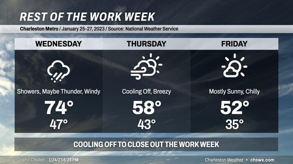
The cold front will move offshore overnight Wednesday into early Thursday morning, which will help us start the day in the low-to-mid-40s. Breezy west winds behind the front will keep temperatures capped to about the upper 50s as cool air continues to move into the area. Winds slacken a little for Friday, but will still make 35° in the morning feel closer to 28°. Highs will only top out in the low 50s despite almost uninterrupted sunshine due to a trough moving across the area.
Beyond the rest of the work week, the weekend looks mostly quiet and increasingly warm as the 60s return. Shower chances increase Sunday evening ahead of another frontal system.
Follow my Charleston Weather updates on Mastodon, Bluesky, Instagram, Facebook, or directly in a feed reader. Do you like what you see here? Please consider supporting my independent, hype-averse weather journalism and become a supporter on Patreon for a broader look at all things #chswx!