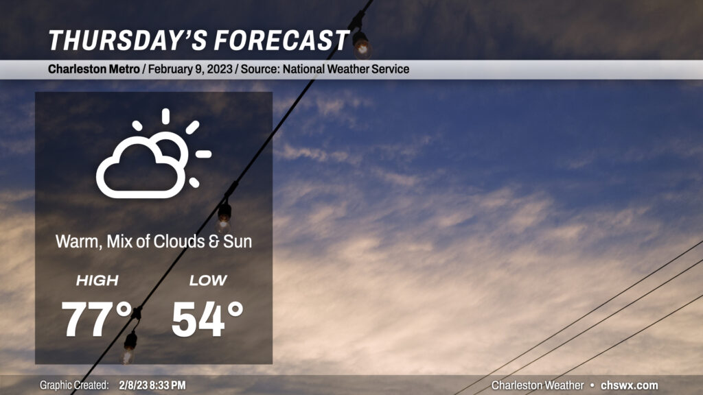
Thursday: One more rain-free day before showers for the weekend

Thursday will be another warm day across the Lowcountry. We’ll start the day with mid-50s and some patches of fog. Heading into the afternoon, highs will top out in the mid-to-upper 70s once again despite more cloud cover than we saw on Wednesday. South winds will be a touch on the breezy side as well. We should get the day in rain-free across much of the area. There’s a small chance that a shower or two could brush the coast in the afternoon, but the bulk of the rain stays away until overnight Thursday into Friday.
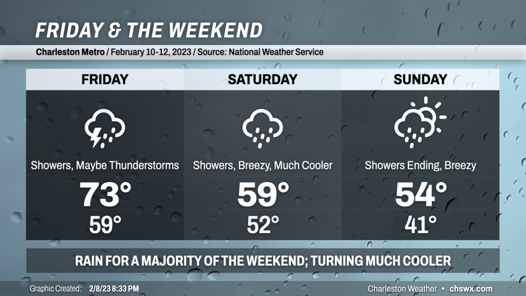
Friday & the weekend: Quite showery, with another 1-2″ of rain possible

The weather takes a turn for the unsettled starting Friday as a cold front approaches the area from the west. We get one more day in the 70s ahead of this front, but plenty of showers are expected within a solid moisture feed from the Gulf. A few thunderstorms can’t be ruled out if instability can materialize, and the wind fields are such that a few stronger storms are possible.
A deep trough coming along with the front will slow down and cut off into an upper low. This is going to help keep the weather quite unsettled into the weekend, particularly Saturday as low pressure develops off the coast. Temperatures will drop into the 50s on Saturday and won’t rise terribly much as the upper low pivots overhead and showers stay in the picture. We stay quite chilly on Sunday as low pressure begins to move northeast, but showers look to hang around for a good bit of the day before gradually tapering off. Highs top out in the mid-50s at best.
It’s worth noting that there’s some rumblings about winter weather in parts of the Carolinas, but it remains to be seen whether this is a solid trend or just some model fantasy. Regardless, the forecast here in the Lowcountry remains solidly for rain, even within the more aggressive models. Stay tuned for updates, but for now, be ready for a weekend that’ll be best experienced indoors.
Follow my Charleston Weather updates on Mastodon, Bluesky, Instagram, Facebook, or directly in a feed reader. Do you like what you see here? Please consider supporting my independent, hype-averse weather journalism and become a supporter on Patreon for a broader look at all things #chswx!