Friday & the weekend: A nice Saturday sandwiched in by rain chances
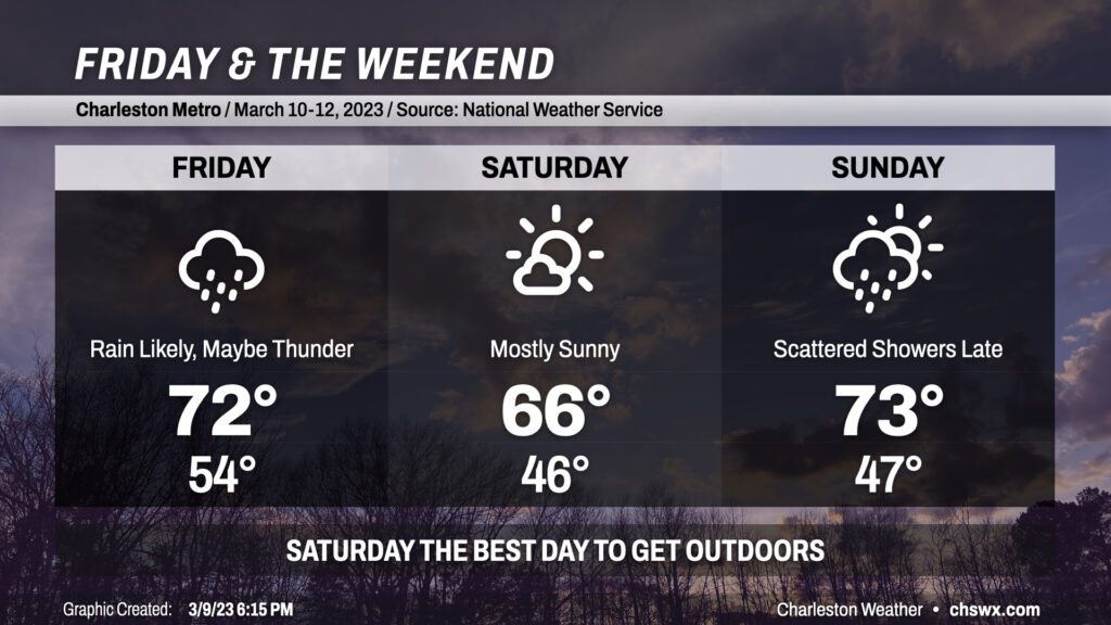
Clouds will be on the increase tonight as a storm system approaches the area from the west. We should remain rain-free through midnight before the atmosphere moistens sufficiently for showers to begin reaching the ground by tomorrow. Rain appears to be most likely from roughly mid-morning into early afternoon before cooler and drier air works into the area. Highs ahead of the front should peak in the low 70s despite the rain. A crack or two of thunder can’t be totally discounted, either.
Saturday is the pick day of the weekend for getting outside: it’ll run a little cooler and skies will be mostly sunny throughout the day. Expect highs to peak in the mid-60s after a start in the mid-40s. We should get Sunday morning in rain-free, especially near the coast, before precipitation chances head back up heading into the afternoon and evening hours. Highs should peak in the low 70s unless showers fire up sooner. The bulk of the rain looks to fall late Sunday into early Monday morning before a reasonably strong cold front punches through the area to send temperatures below normal for a few days next week. Stay tuned for timing changes on the rain as well as potential frost concerns for the middle of next week.