Sunday: Showers increasing in the afternoon
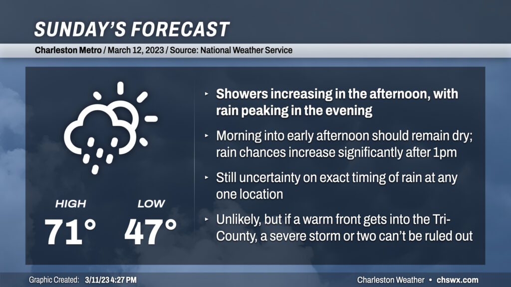
Sunday will start rain-free but with more clouds than sun as moisture builds down into the area ahead of a storm system which will lift a warm front very close by. Low pressure moving along this warm front along with the continued influx of moisture should be enough to kick off some showers and maybe even a thunderstorm starting early afternoon. The peak of the rain should be in the evening hours as the low makes its closest approach, with shower chances hanging around through about midnight. Temperatures will be in the 60s much of the day after warming out of the upper 40s during the morning. As the warm front peeks north, we could briefly touch 70° or so from the metro area southward, but I’d be prepared for a lukewarm rain.
There are a couple potential flies in the ointment for tomorrow: the timing of the onset of showers in the metro area, and the northward extent of the warm front. Most models are on board with at least some showers being in the picture by early afternoon, though some of the higher-resolution, convection-allowing models are holding the rain off a bit longer into late afternoon/early evening, owing to a slower erosion of the dry layer just off the surface. This trend will be worth watching, but I’d count any dry hours in the afternoon as a bonus and keep rain gear handy regardless.
The other thing to watch is the position of the warm front throughout the day. Models generally are counting on a wedge of high pressure to erode northward somewhat as the afternoon goes on, with winds going southerly and dewpoints increasing as a result. By that point, though, we should be in the rain, and the rain-cooled air should tamp down on a more robust thunderstorm threat. However, a little more warmth could allow some instability to develop further north. Shear is good, with good turning of wind with height to boot, so if the instability can be realized, a stronger storm or two wouldn’t be totally ruled out. The Storm Prediction Center has the southern portion of the Tri-County area in a Marginal Risk for severe thunderstorms tomorrow to allow for this small possibility, but severe weather is highly unlikely as the richer moisture looks to stay confined to Georgia.
Follow my Charleston Weather updates on Mastodon, Bluesky, Instagram, Facebook, or directly in a feed reader. Do you like what you see here? Please consider supporting my independent, hype-averse weather journalism and become a supporter on Patreon for a broader look at all things #chswx!