Thursday: Back to the 80s
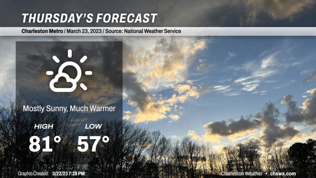
A warm front will lift north of the area tonight, clearing out the light rain and bringing back the 80s to the area for the next several days. We start Thursday in the mid-to-upper 50s, with temperatures warming into the low 80s away from the slightly cooler coastline in the afternoon under increasingly sunny skies. For reference, normal highs for this point in the year are in the low 70s, though we will remain well under the record high of 87° set in 1995. Winds out of the south and southwest will be a little breezy, which might add to some slight complications for any outdoor lunch plans. Other than that, though, a pretty decent late-March day.
Friday & the weekend: Warm weather continues despite a Saturday front
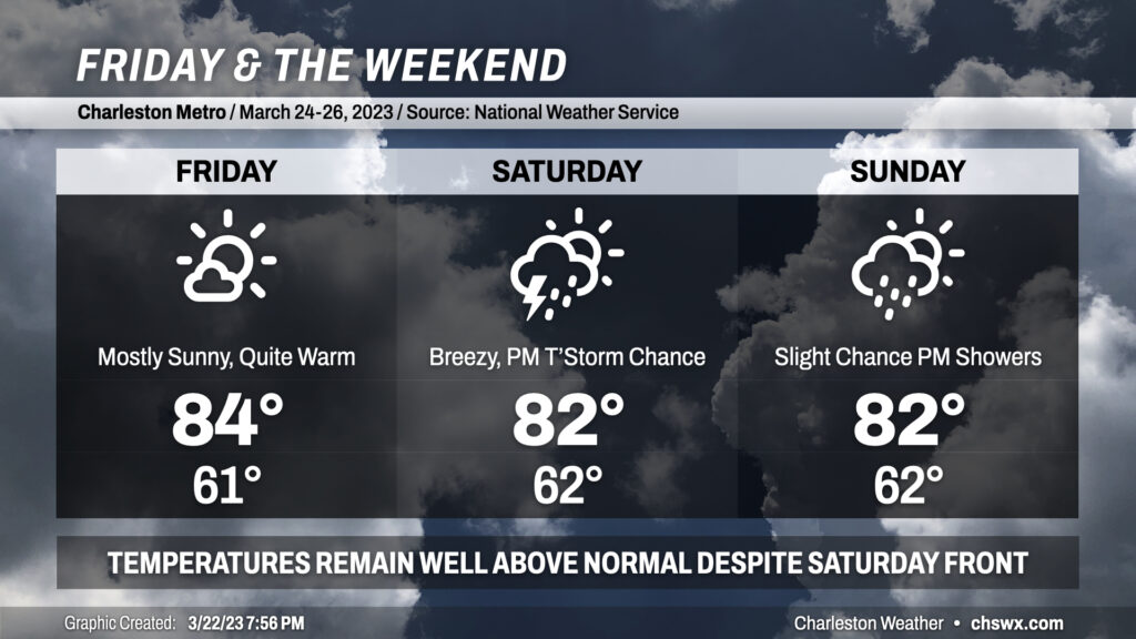
We stay quite warm for Friday into the weekend. Temperatures will remain in the low to mid 80s each afternoon despite a “cold” front projected to swing through later Saturday.
Friday will be the warmest of the set as nearly unfettered sunshine combines with ridging aloft to yield temperatures in the mid-80s in the afternoon. Winds will remain a touch elevated out of the south and southwest, but nothing too much to be concerned about there.
A cold front will approach the area Saturday. It isn’t much of one; the airmass change behind it is relatively minimal. A prefrontal band of showers and thunderstorms could affect the area later Saturday afternoon into the evening, though it might be falling apart a little as it gets closer. Still, depending on the time of day it approaches, the near-storm environment could be interesting as far as the risk for a stronger storm or two, so we’ll want to keep an eye on that. Outside of thunderstorms, winds will take a turn for the gusty as the gradient increases ahead of the front. Gusts 20-30 MPH will be possible, so keep that in mind for any outdoor activities you may have planned. Highs once again peak in the low 80s despite increasing cloud cover and perhaps rain.
The front stalls nearby on Sunday, keeping shower chances in the offing in the afternoon. As mentioned earlier, said front really doesn’t usher in much of the way of a change; dewpoints may run a couple degrees lower Sunday than they did Saturday but other than that, we’ll still feature lows in the low 60s and highs peaking in the low 80s in the afternoon.
Beyond the weekend, expect an unsettled couple days Monday and Tuesday before cooler high pressure builds in Wednesday, swinging temperatures just slightly on the cooler side of normal.
Follow my Charleston Weather updates on Mastodon, Bluesky, Instagram, Facebook, or directly in a feed reader. Do you like what you see here? Please consider supporting my independent, hype-averse weather journalism and become a supporter on Patreon for a broader look at all things #chswx!