Tuesday: Meteorological brilliance

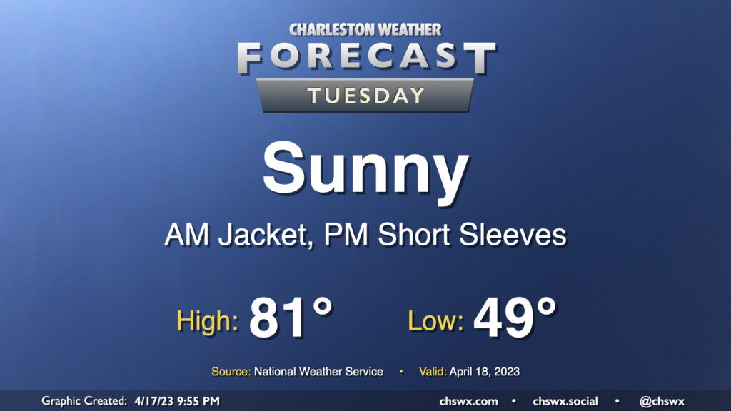
Tuesday will be one of those meteorologically brilliant days that will undoubtedly make all of us wish it was the weekend instead. We start the day in fairly crisp fashion with lows bottoming out in the upper 40s to around 50°. High pressure will sit atop the area, and this combined with a very dry airmass will keep the sky unmarred by cloud cover. Temperatures will respond nicely, warming about 30° to the low 80s in the afternoon. Winds will be a little lighter, starting out of the north and swinging around to the northwest, west, and finally south by sunset.
Rest of the work week: Warm temperatures and mostly clear skies persist

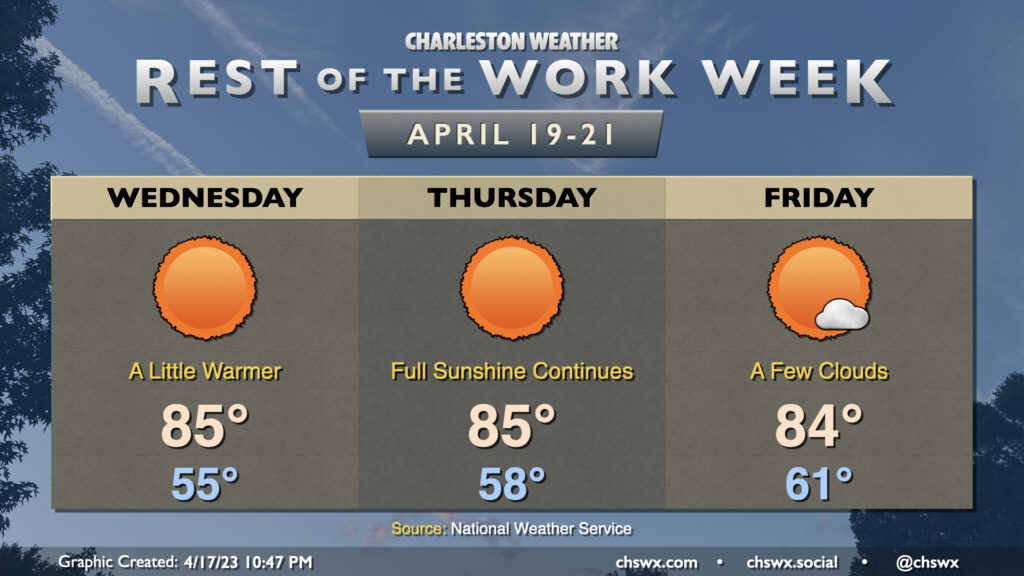
Quiet weather will continue through the end of the work week. High pressure will slip into the Atlantic by Wednesday, turning winds more southerly. This will kick the dewpoints a little higher and turn us a little warmer, with highs topping out in the mid-80s — several degrees above normal for this point in April — Wednesday through Friday. Lows steadily creep up with the dewpoints; we start at 55° on Wednesday, 58° Thursday, and then in the low 60s by Friday. Nevertheless, predominantly sunny skies will continue as a deep-layer ridge keeps stable air in place, and it still won’t feel bad at all outside.
The next shower chance is, of course, Saturday, though it’ll be a slight one in the afternoon. Our next front moves by Sunday with a few more shower chances and another shot of cooler and drier air to start — you guessed it — another work week.
Follow my Charleston Weather updates on Mastodon, Bluesky, Instagram, Facebook, or directly in a feed reader. Do you like what you see here? Please consider supporting my independent, hype-averse weather journalism and become a supporter on Patreon for a broader look at all things #chswx!