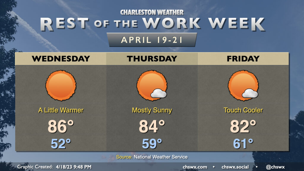
Rest of the work week: Sunshine continues as warmth peaks Wednesday

Quiet weather continues through the end of the work week. Wednesday will run quite a bit warmer than the past couple days as stacked high pressure settles in right over the Carolinas. Surface high pressure will slip into the Atlantic during the day Wednesday, turning winds a little more southerly and allowing temperatures to rise well into the mid-80s. The aforementioned high pressure will keep cloud cover to an absolute minimum, much like we saw on Tuesday.
On Thursday, we start to see the ridge aloft move a little more into the Atlantic. This will allow for a sparse fair-weather cumulus field to develop, but other than that, we stay predominantly sunny. Highs look to top out in the mid-80s once again, though we get off to a warmer start to the day than we did Wednesday with lows bottoming out in the upper 50s.
The ridge continues further offshore on Friday. We start the day in the low 60s with a little more humidity as dewpoints gradually climb behind the high and ahead of an incoming cold front. Surface winds will come around to the southeast, which will help keep high temperatures capped to the low 80s thanks to a little more onshore flow. Once again, expect a fair-weather cumulus field in the afternoon but nothing else of note.
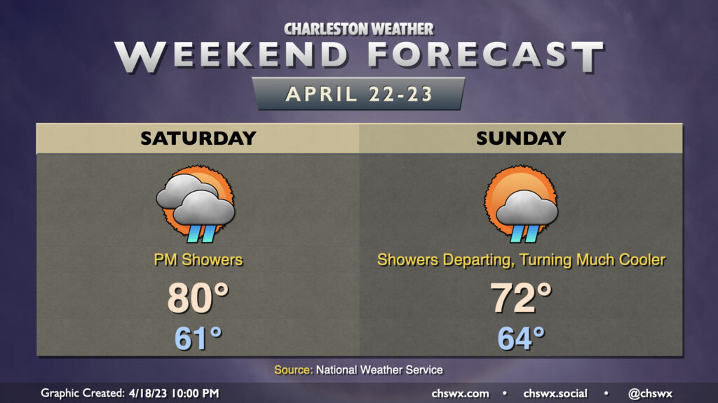
Weekend preview: Cold front brings Saturday showers and a Sunday cooldown

Changes are coming over the weekend as another cold front approaches the area. We start Saturday dry, but as the front approaches, some showers and maybe a thunderstorm will accompany it as we head into Saturday afternoon and evening. Modeled shear profiles look a little interesting as we get into Saturday evening, and there looks to be a decent amount of instability, so the severe potential appears non-zero. Something to watch, but nothing too definitive just yet. Outside of showers and thunderstorms, some gusty winds will be possible.
Showers continue overnight Saturday into Sunday morning as the front passes by. Cooler and drier air will push into the area as Sunday goes on, so while we may start the day in the mid-60s, we won’t get too much warmer — low 70s at best with clearing skies and some gusty winds as the aforementioned cooler and drier air advects into the area. Below-normal temperatures look to continue as we start the first half of the next work week, too.
Follow my Charleston Weather updates on Mastodon, Bluesky, Instagram, Facebook, or directly in a feed reader. Do you like what you see here? Please consider supporting my independent, hype-averse weather journalism and become a supporter on Patreon for a broader look at all things #chswx!