Weekend forecast: Warm and dry day Saturday, storms arrive in the evening and last through Sunday
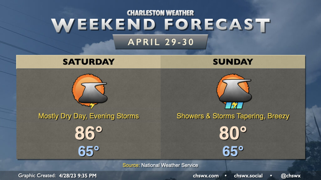
Saturday looks to be a fairly warm and muggy day — a tiny sliver of a summer preview — as we start the day in the mid-60s and top out in the mid-80s in the afternoon. We’ll stay rain-free for much of the day before a cold front and an accompanying upper low starts to get closer to the area. Shower and thunderstorm chances will subsequently increase, and a strong to severe storm isn’t totally off the table later Saturday given sufficient shear. Some heavy rain will be possible overnight and into early Sunday morning as well, with local amounts possibly exceeding an inch of rain before it’s over.
Showers and storms look to be ongoing as we head into Sunday morning, but will taper off as the day goes on as low pressure lifts northeast and the aforementioned cold front moves through. By Sunday evening, we should be largely rain-free and cooling off as a drier airmass builds into the area post-frontal passage. Highs top out around 80° in the afternoon. Winds will be elevated, with gusts 25-30 MPH possible particularly as we get into the afternoon hours as the mixed layer rises to around 6,000 feet, tapping into a decently strong low-level jet, which will hang around for the subsequent few days to provide a gusty start to May.