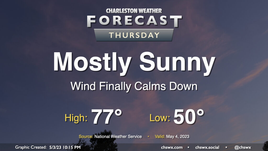
Thursday: Another comfortably warm day — minus the wind

Thursday will represent the peak of our stretch of nice weather for one main reason: the pressure gradient that has kept our winds elevated for several days will finally have relaxed, bringing winds down to a light breeze during the day. Otherwise, it’s a carbon copy of Wednesday: Lows around 50°, with highs in the mid-70s in the afternoon under mostly sunny skies. I hope you can take advantage!
Friday & the weekend: Seemingly on cue, turning unsettled

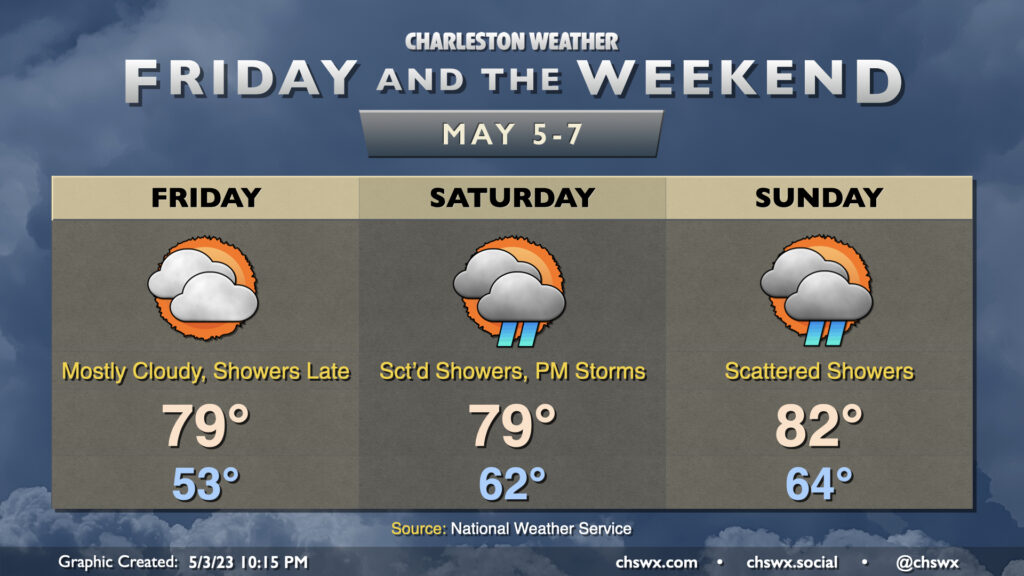
High pressure, responsible for the gorgeous weather we’ve been experiencing, will begin to slip offshore on Friday. This will begin some moisture return into the area, and as a result temperatures will approach 80º in the afternoon with increasing cloud cover and humidity. Showers could break out as soon as Friday evening, but the better — albeit scattered — shower chances will arrive Saturday and continue through much of the day as a backdoor front moves on by. A thunderstorm or two isn’t out of the cards either in the afternoon. The shower activity should limit highs to around 80°, if not a tad below.
Scattered showers remain possible during the day Sunday, with an isolated thunderstorm not totally out of the question in the afternoon. Highs will run warmer, though, with low 80s expected after starting the day in the mid-60s. As is custom in 2023, the weekend is not a total washout, but we just can’t escape the grasp of a few scattered showers at times. So it goes.
Follow my Charleston Weather updates on Mastodon, Bluesky, Instagram, Facebook, or directly in a feed reader. Do you like what you see here? Please consider supporting my independent, hype-averse weather journalism and become a supporter on Patreon for a broader look at all things #chswx!