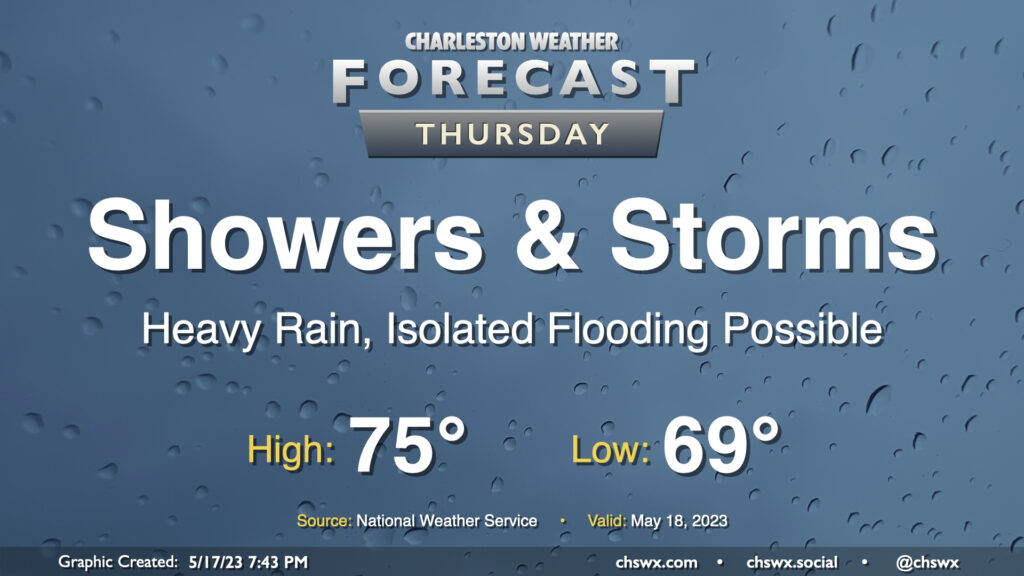
Thursday: Heavy rain at times, with salt water flooding in the evening

A cold front will slowly push south across the area overnight into Thursday, but it will not bring rain chances to a close. Moisture riding atop a wedge of high pressure will keep plentiful showers and maybe some thunderstorms in the forecast. Some spots may see an additional 1-2″ of rain on top of the rain that fell on Wednesday, and additional bouts of flooding may be possible as a result. The risk for severe weather will be lower given the widespread precipitation as well as the cooler temperatures, especially behind the front. Expect highs to only top out in the mid-70s with a breezy northeasterly wind.
We’ll need to monitor for the risk for moderate coastal flooding with the 8:08 PM high tide. The current forecast is for water levels to peak between 7.5-7.7′, which should be enough to close several roads in downtown Charleston. We will obviously want to watch very closely for the prospect of heavy rain in the area around this time as the coincidence of the two would be decidedly not great. Stay tuned to forecasts throughout the day, especially if you have downtown in your plans Thursday night.
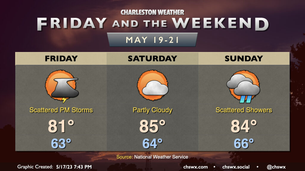
Friday & the weekend: Staying periodically unsettled

The cool wedge of high pressure will begin breaking down Friday, allowing temperatures to head back into the low 80s in the afternoon. Scattered afternoon thunderstorms are a possibility, though certainly not the coverage we saw Wednesday and expect to see Thursday.
Saturday is the pick day of the weekend; it looks to stay primarily rain-free, with highs getting into the mid-80s under partly cloudy skies. Sunday should feature some scattered showers and maybe some thunder late as another front approaches the area. Highs once again top out in the mid-80s after starting in the mid-60s, generally in line with mid-May normals.
Follow my Charleston Weather updates on Mastodon, Bluesky, Instagram, Facebook, or directly in a feed reader. Do you like what you see here? Please consider supporting my independent, hype-averse weather journalism and become a supporter on Patreon for a broader look at all things #chswx!