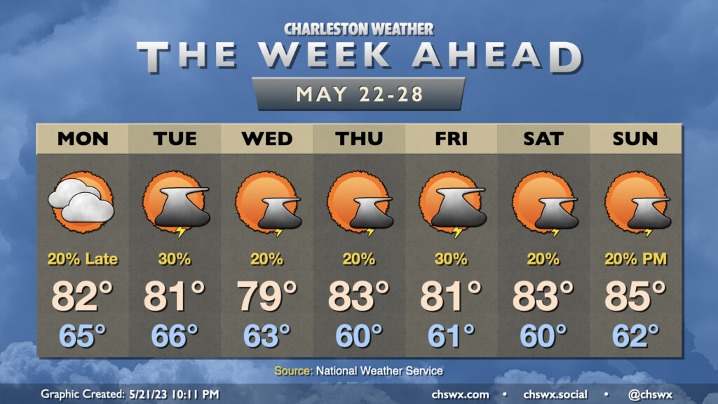
The week ahead: Cooler than normal temperatures with a few showers and storms at times

One thing you might notice right away when peering at the week ahead is that temperatures for the week ahead look more like early May as opposed to late May. Highs will generally top out in the low 80s for much of the week (and Wednesday might not even crack 80°!) as cool high pressure builds into the area and stays in force. Upper-level disturbances swinging through will keep isolated to scattered thunderstorm chances in the forecast, primarily in the afternoons (though some popup showers can’t be ruled out in the mornings, either).
The second half of the week will have some details to iron out regarding an area of low pressure that will move northward, parallel to the coast. The question ultimately is how far west it gets; it may spread some gusty rains ashore Thursday into Friday if it gets a little too close. Stay tuned for forecast updates.
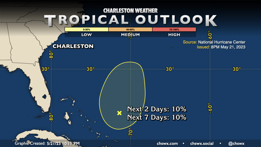
Tropical outlook: Area of low pressure has NHC’s eye

Nothing says “’tis the damn season” quite like the first area of interest from NHC for possible tropical development of the year. Wind shear is more than likely going to prevent this from getting going too much as it moves northward over the next few days, but it acts as an excellent reminder that the start of hurricane season is under two weeks out (June 1). The time to prepare is now — before we have a storm bearing down on us. Visit https://hurricane.sc to find the online South Carolina Hurricane Guide, which gives you everything you’d want to know about how to prepare for a landfalling hurricane.
Follow my Charleston Weather updates on Mastodon, Bluesky, Instagram, Facebook, or directly in a feed reader. Do you like what you see here? Please consider supporting my independent, hype-averse weather journalism and become a supporter on Patreon for a broader look at all things #chswx!