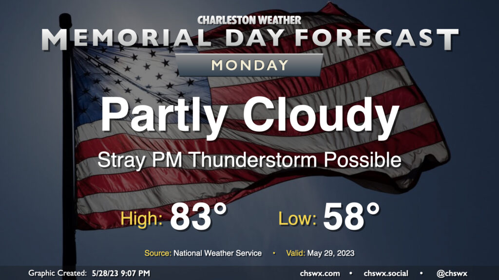
Memorial Day forecast: The sun returns, but a storm is possible in the afternoon

The sun will make a return to our skies for Memorial Day as surface low pressure continues to move away from the area and westerly winds dry things out a bit. We start the day much cooler than normal, with lows bottoming out in the upper 50s. (The record low of 53° set in 1961 remains safe.) Sunshine and the aforementioned westerly winds should help highs top out in the low 80s — a couple ticks below normal as well, but certainly much more seasonable than the 60s and 70s of recent days. The only fly in the ointment may be a stray thunderstorm or two in the afternoon as the seabreeze moves inland. If the beach is in your Memorial Day plans, keep an eye out later in the afternoon as storm motions will be toward the coast. Otherwise, no concerns.
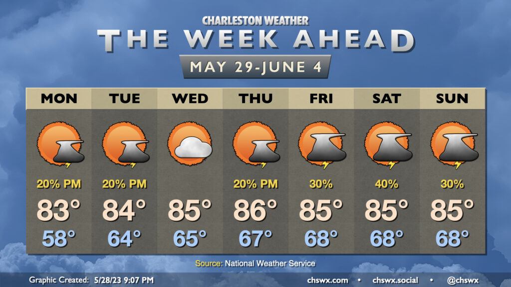
The week ahead: Near-normal temperatures and afternoon storm chances as we kick off June

Temperatures will warm to around, if not slightly below, normals for this point in the year as we wave goodbye to May and ring in June (and climatological summer). Much of the work week will feature partly cloudy skies with a slight chance of an afternoon thunderstorm or two as the seabreeze does its thing. Highs generally top out in the mid-80s after starting in the mid-60s.
Heading into Friday and the weekend, things may turn a little more unsettled as mid-level heights come down a bit and some vorticity moves on by which could help the seabreeze kick up a little more coverage of afternoon storms. A front could also approach the area over the weekend. Otherwise, generally expect mid-80s in the afternoon after starting each day in the upper 60s.
Follow my Charleston Weather updates on Mastodon, Bluesky, Instagram, Facebook, or directly in a feed reader. Do you like what you see here? Please consider supporting my independent, hype-averse weather journalism and become a supporter on Patreon for a broader look at all things #chswx!