Rest of the work week: A slightly cooler than normal start to June
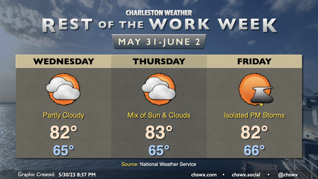
The forecast for the rest of the work week is pretty straightforward: a mix of sun and clouds each day, with temperatures starting the day around normal before topping out a few degrees below normal each afternoon. Highs will generally run in the low 80s after starting each day in the mid-60s, somewhat unusually “cool” for the end of May and beginning of June. Precipitation chances will be minimal Wednesday and Thursday, with a slight chance of an evening thunderstorm on Friday.
Tropics: NHC watching an area in the Gulf, but development is unlikely
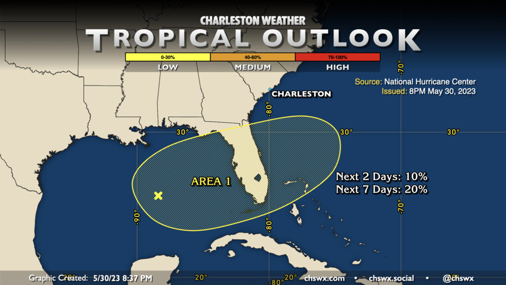
The National Hurricane Center is monitoring an area of disturbed weather in the Gulf of Mexico that’ll hang there for a few days before heading over Florida and out into the Atlantic, well away from the US mainland. Development appears unlikely, but it’s a good reminder that we are back in hurricane season on Thursday. It’s best to prepare when things are quiet, and https://hurricane.sc has great information to help you do just that.
Follow my Charleston Weather updates on Mastodon, Bluesky, Instagram, Facebook, or directly in a feed reader. Do you like what you see here? Please consider supporting my independent, hype-averse weather journalism and become a supporter on Patreon for a broader look at all things #chswx!