The week ahead: Quite unsettled

We have an unsettled week of weather ahead as an upper low cuts off across the Southeast, blocked in by high pressure to the north — much as we saw at the start of the month, in fact, though we’ll do without the highs in the 60s this go-around.
Juneteenth should get off to a fairly quiet start, but expect showers and thunderstorms to blossom in coverage during the afternoon along the seabreeze and other outflow boundaries in a warm and muggy airmass. We start the day in the low-to-mid-70s before warming to the mid-80s in the afternoon ahead of expected thunderstorm development.
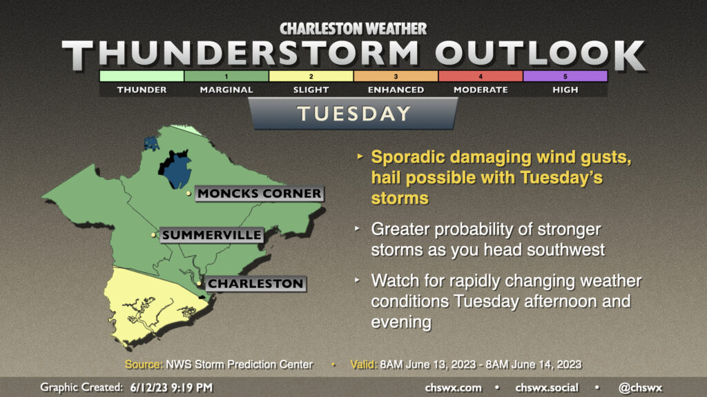
Tuesday through Thursday look to be the wettest days of the set with the blocking pattern firmly in place. Expect rounds of showers and thunderstorms each day, though nailing down the timing of said storms will be a day-to-day kind of thing. Highs will run a few degrees below normal for mid-to-late June, generally in the mid-80s.
The blocking pattern looks to start to break down Friday, though continued troughing aloft will keep a feed of Gulf moisture moving across the area, with precipitable water values likely around 2″+ through Sunday — a pretty moist atmosphere, suffice to say, that should keep plentiful showers and thunderstorms around into the weekend. Note, though, that it won’t be raining all the time, either, but it’s just tough to tell this far out when we’ll get those breaks.
Precipitation forecast

We’ll likely make up the year-to-date 2.67″ rainfall deficit this week and then some — likely tipping into a rainfall surplus before it’s all said and done. Overall this week, we can expect as much as 3-5″ of rain in spots, and even heavier amounts in some spots might not be out of the question. There will be a risk for some flooding this week as a result particularly as we get into mid-week. Check back for updates as this will be a situation that’ll need adjustments day-to-day.
Tropical update: Two areas of interest in the central and eastern Atlantic…in June

The National Hurricane Center continues to monitor an area of disturbed weather, dubbed Invest 92L, around 33°W and 11°N for likely tropical development in the next day, giving the wave a 90% chance of development. Guidance is mixed on the solutions with 92L for now — the GFS ensembles have a stronger system that recurves away from land, while the ECMWF ensembles favor a weaker system that makes more of a westward trek. Big wait-and-see with this one, but once a center forms, we should start to get a better idea as to what’s what.
With the 8PM update, NHC highlighted another wave in the wake of 92L — generally south of the Cabo Verde Islands — which is displaying some propensity for circulation, and gives this area a 20% probability of developing over the next seven days.
Both of these waves currently don’t — and likely won’t — pose any risk to the US. If that changes, I’ll let you know.
And yes: It’s weird to see not just one, but two areas of development this far to the east in June, but so it goes when sea surface temperatures are running well above normal and into the favorable range for tropical development (generally 80°F and higher). This abnormal Atlantic warmth could prove to be an interesting wrinkle with the seasonal outlooks over the next few months despite El Niño — stay tuned…
Follow my Charleston Weather updates on Mastodon, Bluesky, Instagram, Facebook, or directly in a feed reader. Do you like what you see here? Please consider supporting my independent, hype-averse weather journalism and become a supporter on Patreon for a broader look at all things #chswx!