Sunday’s forecast: Storms turning likely by evening

Standard July warmth and mugginess will continue on Sunday. We’ll start the day in the mid-70s under partly cloudy skies, and we should get the first part of the day in rain-free. From there, we’ll start to see showers and thunderstorms develop by mid-afternoon and make their way into the area from the west and southwest throughout the rest of the evening. The strongest storms could produce strong wind gusts, while heavy rain and frequent lightning will be more widespread concerns. Be ready to bring outdoor activities inside if thunderstorms approach.
Possible tornado this evening in northern Berkeley County; no damage reports
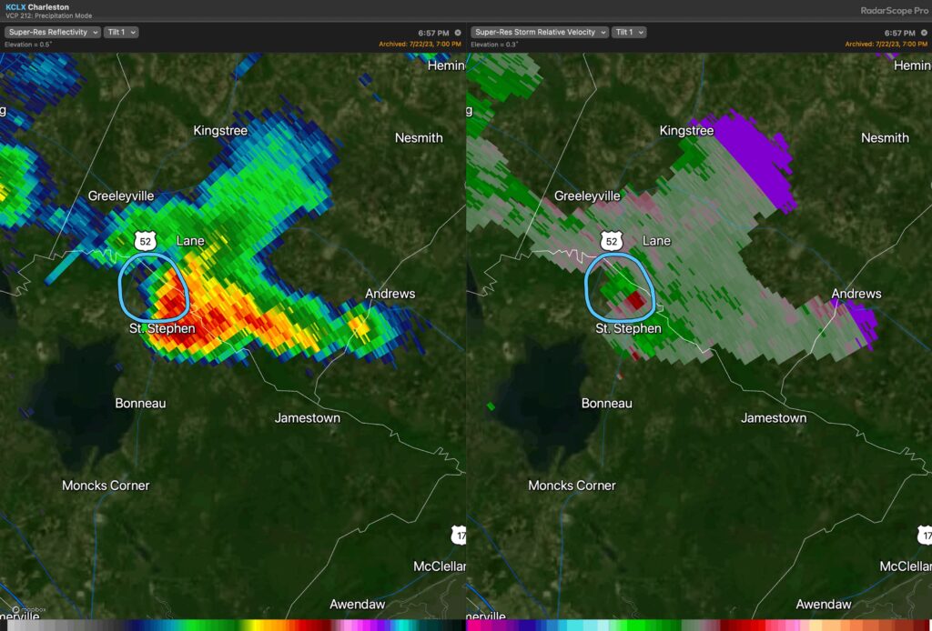
There was a tornado warning in northern Berkeley County earlier Saturday evening as a thunderstorm along an outflow boundary possibly intersected with the lake breeze to produce some rotation in the mid-levels.
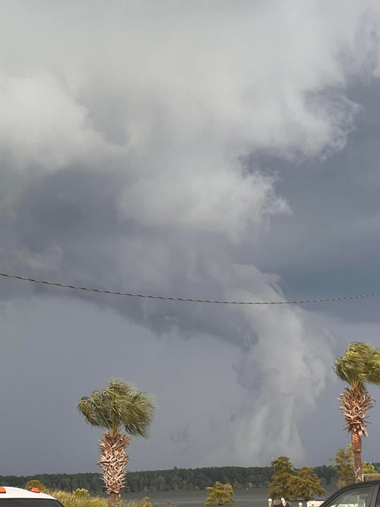
At 7PM, NWS relayed that law enforcement had reported a tornado near St. Stephen, which corresponds well with the rotational couplet. A photo of the storm is largely inconclusive, though. There is a cloud very low to the ground, but the appearance is very ragged…and without video, it’s hard to know if it was rotating or not. Taking a look at the base of the cloud — an important technique in storm spotting — doesn’t seem to show any debris, and no damage has been reported as of this writing. It’s unclear if this storm will be surveyed or not, but regardless, it certainly made Saturday evening a little more interesting than we might have liked.
Tropics: Don becomes the first hurricane of the season
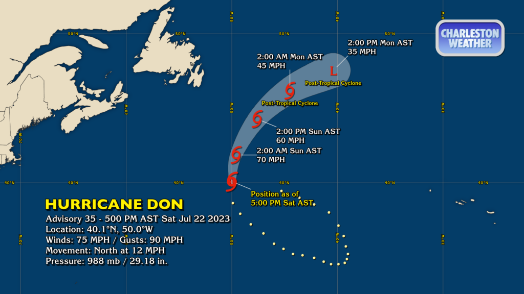
Don, which has been looping in the northern Atlantic for the past week or so, is the first hurricane of the 2023 season as of Saturday evening. It won’t have long at this intensity as it continues to move northward into cooler water, and it will likely become a post-tropical cyclone by Monday. Don remains no threat to land.
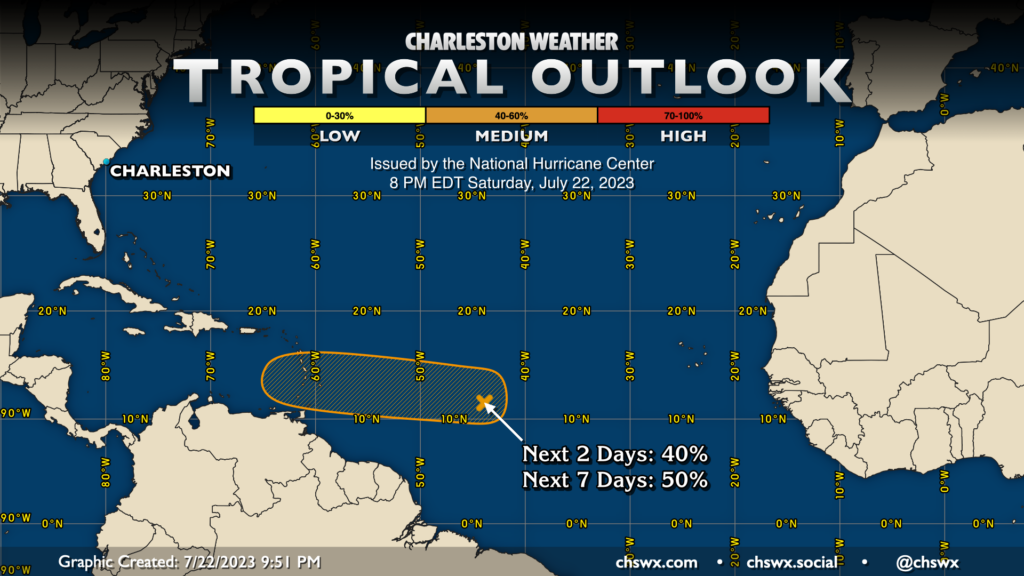
The National Hurricane Center has brought the chances for a disturbance approaching the Lesser Antilles to develop into a tropical cyclone down a notch as it has weakened quite a bit. However, the Hurricane Center still gives the disturbance about 50% odds to develop over the next week. We’ll keep an eye on it, but no imminent concerns for the Lowcountry.
Follow my Charleston Weather updates on Mastodon, Bluesky, Instagram, Facebook, or directly in a feed reader. Do you like what you see here? Please consider supporting my independent, hype-averse weather journalism and become a supporter on Patreon for a broader look at all things #chswx!