The week ahead: Exchanging excessive heat for more rain

After what ended up being quite a hot weekend, we have a day or two more of advisory-level heat (maybe even warning-level heat in a few spots) before a front moves into the area and brings some more unsettled weather for a few days.
Heat advisory on Monday (and maybe again Tuesday)
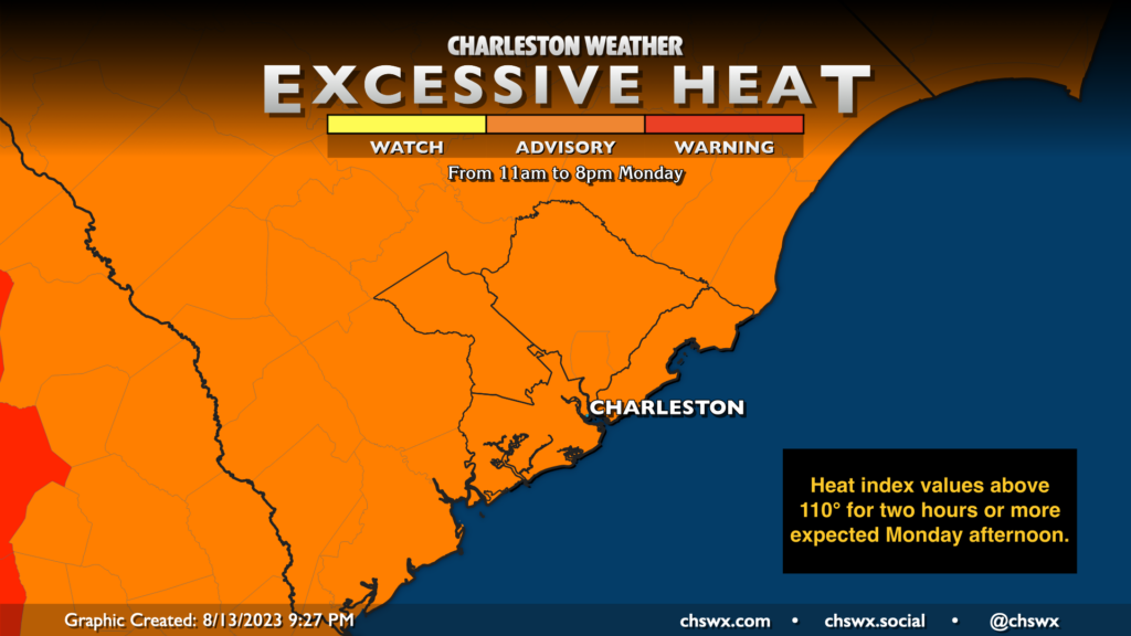
Another hot day is expected for Monday. Low temperatures may not go below 80° across the metro before highs in the mid-90s combine with upper-70s dewpoints to once again produce heat indices exceeding 110° in many spots, especially near the coast. A Heat Advisory will go into effect at 11am and is scheduled to go until 8pm. Like Sunday, a few spots could see some showers and thunderstorms to provide at least some heat relief, but I wouldn’t bet on it as coverage should be generally isolated in nature along and ahead of the seabreeze.
Another heat advisory is on the table for Tuesday with grotesque morning lows around 80° and air temperatures heading into the mid-90s in the afternoon. Upper-70s dewpoints should send heat indices toward 110° one more time, though with better chances of afternoon thunderstorms as a front approaches the area, it is possible (hopeful?) those conditions will be shorter-lived. Thunderstorms on Tuesday could be prolific rain producers given precipitable water values well over 2″, so watch for the potential for some flooding in a few spots as well as some gusty winds.
The front will stall out nearby Wednesday, bringing in at least some slightly lower-dewpoint air and cooler temperatures (low 90s vs. mid-90s still counts). We could still see decent afternoon and evening shower and thunderstorm coverage, though, depending on where the front sets up, so be ready for disruptions during the evening commute. Showers and thunderstorms are likely on Thursday as well, though timing becomes a little more fuzzy as we get later into the week.
As we get into Friday and the weekend, expect more typical summertime conditions with afternoon thunderstorms possible along and ahead of the seabreeze. Highs will run in the low-to-mid-90s with lows in the mid-70s each day.
Tropics: A couple areas way out there to watch
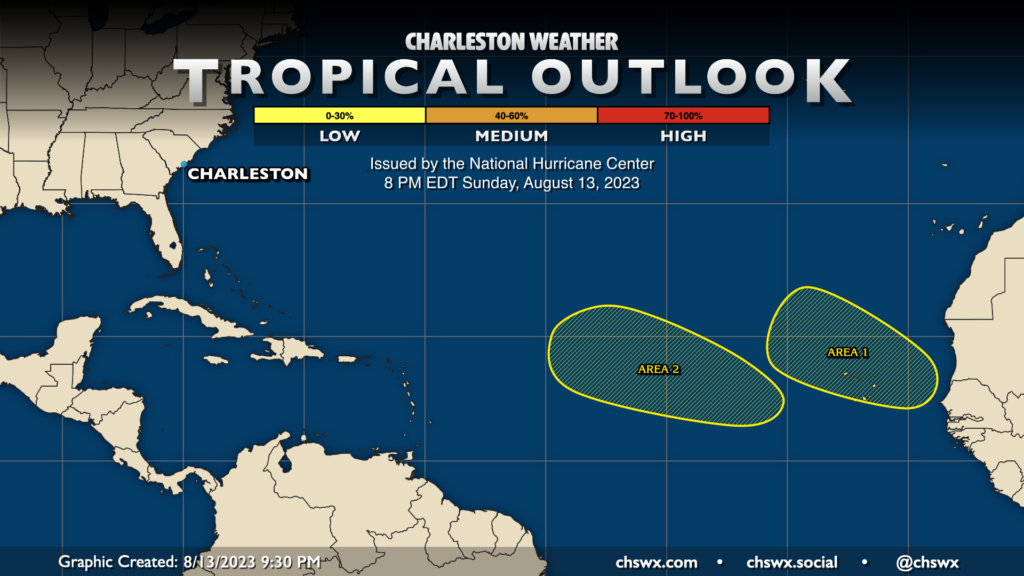
Finally, we are starting to get into the thick of the Atlantic hurricane season, and there are two areas the National Hurricane Center is keeping an eye on this week, though they are very far away from us. A couple waves are expected to come off the coast of Africa in the coming days, and there is a small chance in the next week that one or both of them could develop into a tropical cyclone. Right now, though, there are no imminent concerns for us here in the Lowcountry, but now is the time to watch and prepare as these things can turn on a dime.
Follow my Charleston Weather updates on Mastodon, Bluesky, Instagram, Facebook, or directly in a feed reader. Do you like what you see here? Please consider supporting my independent, hype-averse weather journalism and become a supporter on Patreon for a broader look at all things #chswx!