Rest of the work week: Turning cooler as high pressure wedges in
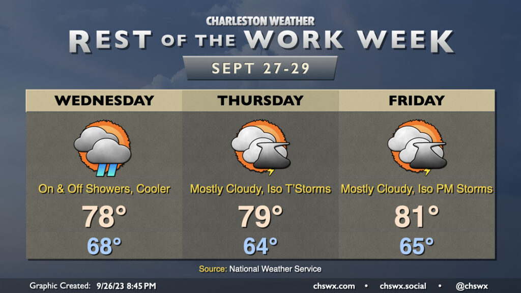
High pressure wedging into the area will keep us on the somewhat cool and cloudy side for the next few days, with shower chances peaking Wednesday before tapering off for Thursday and Friday (though cloud cover and the occasional shower or storm will linger). Highs on Wednesday and Thursday shouldn’t get out of the upper 70s, while we may trend a little warmer Friday as some drier air begins to work in and a little more sunshine becomes possible.
Coastal flooding to continue for the rest of the week (and perhaps beyond)
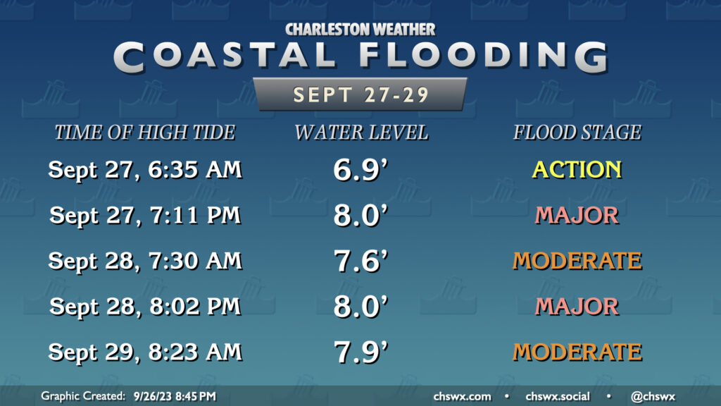
Coastal flooding will remain a problem as the week goes on. High tide Tuesday evening topped out around 7.24′, and departures will generally head up from there as we get further into the week. Major coastal flooding is forecast for Wednesday evening’s high tide, which should top out around 8′ around 7:11 PM. Flooding should begin in time for the evening commute and worsen as the commute goes on. Keep this in mind if downtown Charleston is part of your commute, especially around the hospital district.
Coastal flooding will increasingly impact the morning commute as we get into Thursday and Friday, with moderate flooding expected around the 7:30 AM high tide Thursday and water levels approaching major flood stage around Friday’s 8:23 AM high tide, with another round of major coastal flooding sandwiched between the two on Thursday evening for good measure.
Remember, never cross a flooded road, especially in these situations — this is salt water, and it is unkind to vehicles’ undercarriages!
Tropics: Philippe perhaps not long for this world; next depression seems imminent
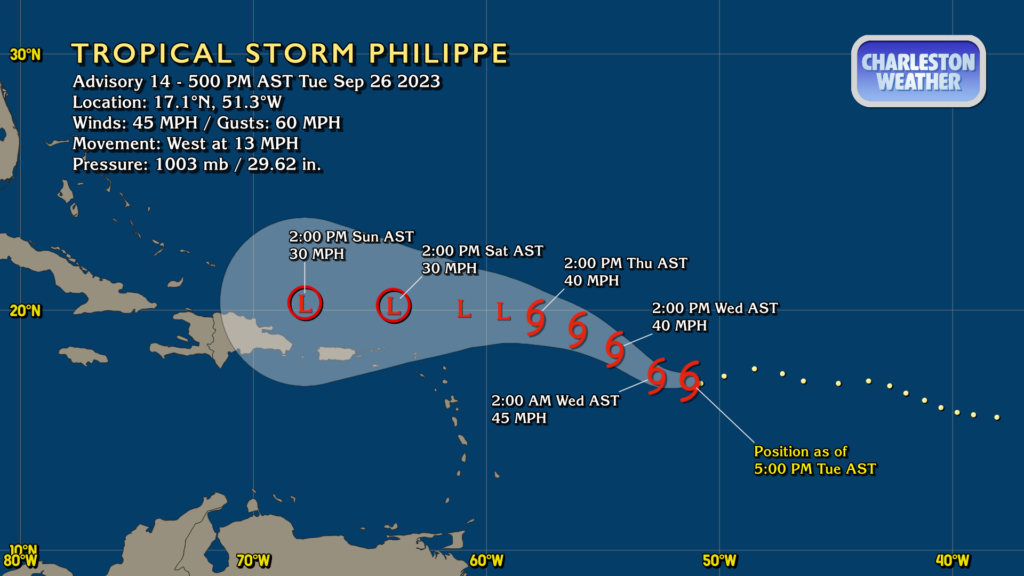
Tropical Storm Philippe is continuing to struggle against wind shear, which is keeping thunderstorms displaced well away from the center of circulation and just not allowing the storm to gain any strength. The current NHC forecast has it becoming a depression again by Friday, and it may shear out into a post-tropical low or even just a trough by the weekend. Philippe is not a concern for the Lowcountry.
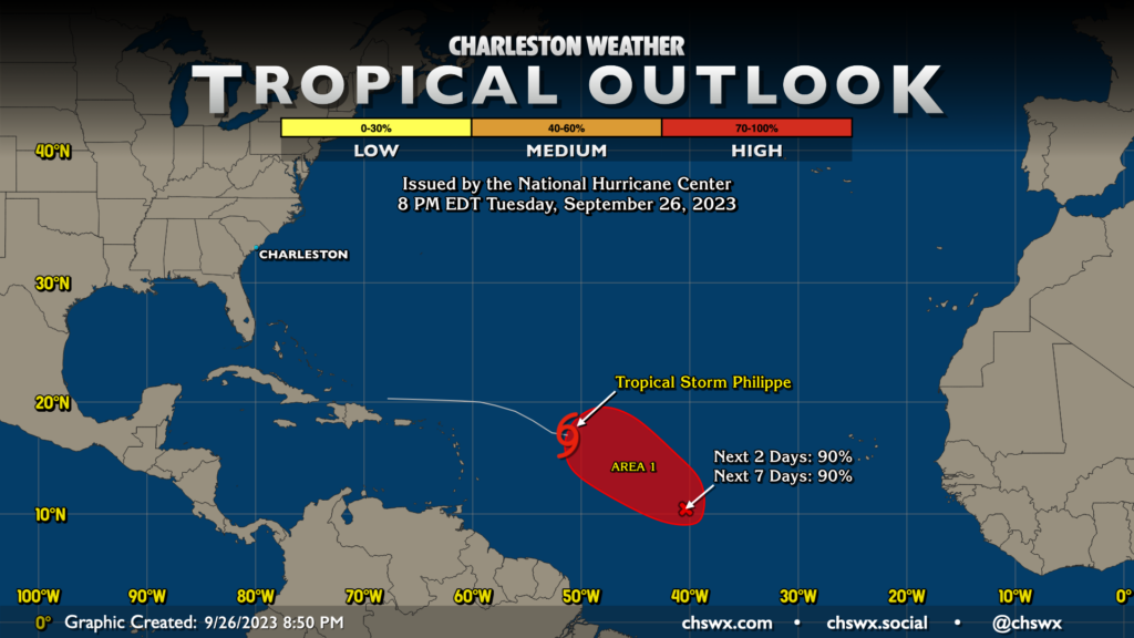
The only other area of interest in the Atlantic right now is Invest 91L, which looks like it will become our next depression fairly soon. NHC gives it a 90% chance to develop into one in the next two days, so we shouldn’t get out of this week without it developing. It’s got plenty of room to maneuver in the Atlantic, and right now it doesn’t appear to be a concern for our neck of the woods, but we’ll keep an eye on it as it’s early in the game. The next name on the list is Rina.
Follow my Charleston Weather updates on Mastodon, Bluesky, Instagram, Facebook, or directly in a feed reader. Do you like what you see here? Please consider supporting my independent, hype-averse weather journalism and become a supporter on Patreon for a broader look at all things #chswx!