Thursday: Rain tapers, temperatures quite seasonable
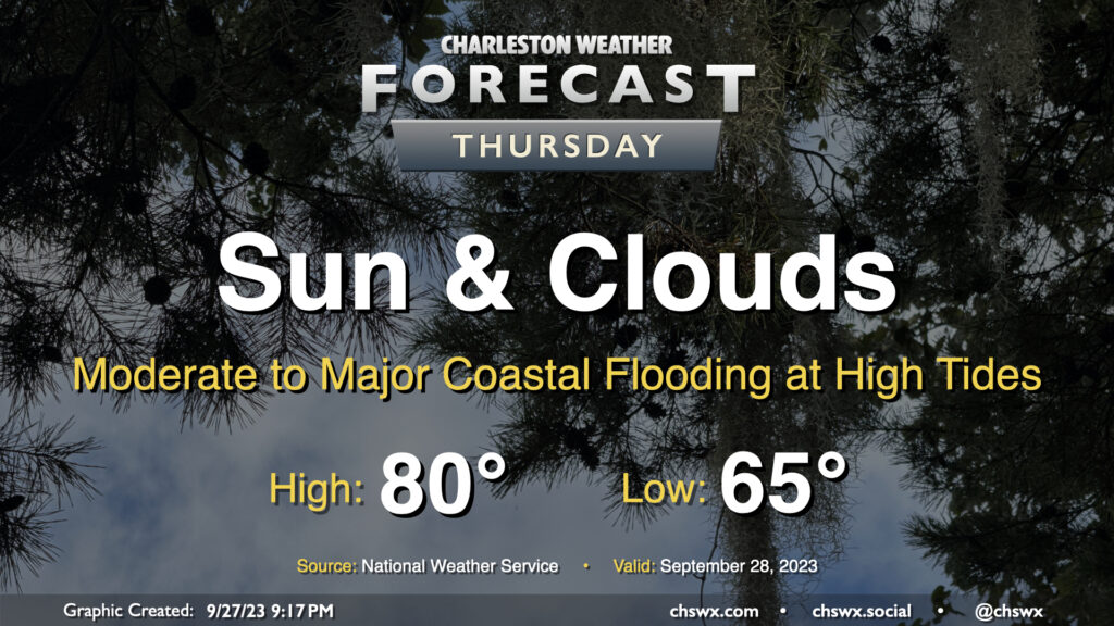
Rain will generally be a non-factor in our weather starting Thursday (except for maybe some brushes near the coast) heading into Friday and the rest of the weekend. We start the day around 65° with some cloud cover in the area. A northeasterly breeze courtesy of high pressure wedging into the area from the northeast will continue to keep temperatures down to about 80° at warmest in the afternoon with cloud cover hanging around. We should see some sun break through at times as well, though.
The main weather concern will be coastal flooding at times of high tide, and it could be somewhat disruptive to the morning commute in particular. High tide around 7:30am will top out around 7.9′, which is the high end of moderate flood stage in Charleston Harbor. The evening high tide should reach even higher, with water levels around 8.1′ expected around 8pm. Watch for road closures as you commute Thursday morning and then again a little later Thursday evening, particularly if downtown is in your plans.
Friday & the weekend: High pressure in control, comfortable temperatures
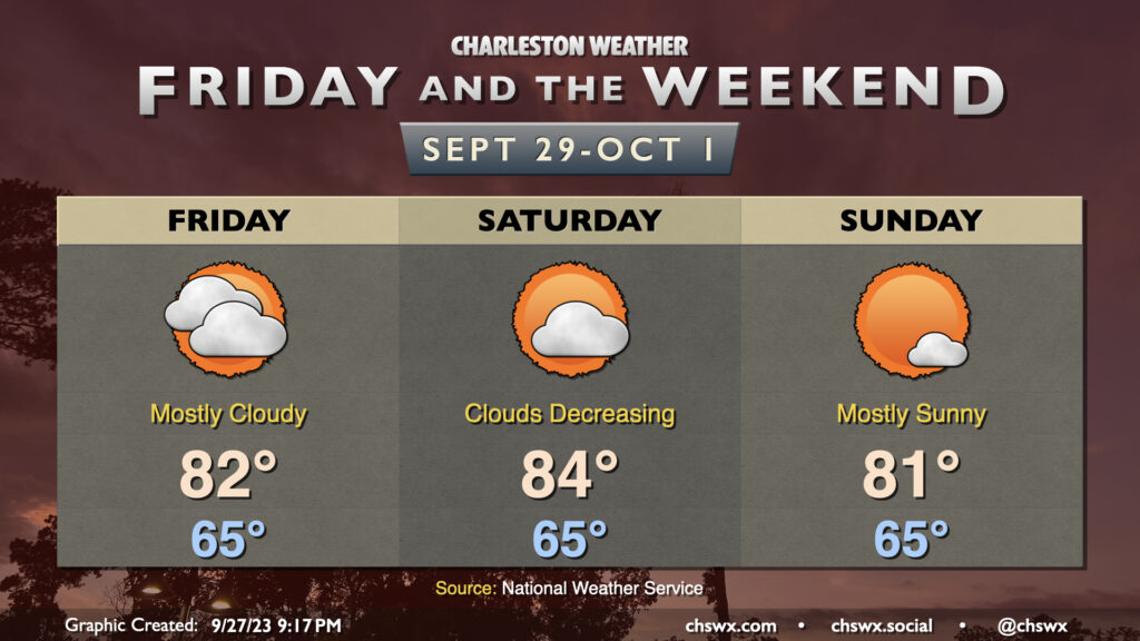
High pressure will remain in control over the weekend as gradually drier air slowly scours out cloud cover, allowing temperatures to warm a little higher into the low 80s (especially Saturday). Northeasterly winds will continue across the area, and this will help keep the risk for coastal flooding elevated. Aside from the tidal issues, it should be a fairly nice weekend all things considered, with comfortable temperatures and improving amounts of sunshine.
Coastal flooding — potentially significant at times — expected with high tides into the weekend
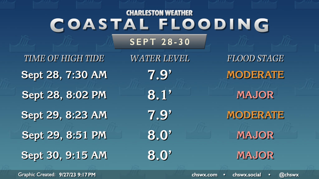
The upcoming full moon at perigee and the ongoing northeasterly winds will keep the risk for significant coastal flooding at times of high tide in play heading into the weekend. A Coastal Flood Advisory is already out for Thursday morning as water levels should reach well into moderate flood stage in the harbor once again, perhaps flirting with major flood. We’ll almost certainly reach major flood stage Thursday evening as water levels are forecast to peak around 8.1′. We’ll keep the very high tides going on Friday into Saturday as well, with moderate flooding possible Friday morning and then perhaps two runs at major flooding Friday evening and again Saturday morning. Suffice to say, there will be disruptions at times if downtown is involved in your commute or is otherwise in your plans. Be listening for Coastal Flood Advisories or Warnings as those will let you know when the risk for flooding is highest.
Tropics: Philippe continues heading westward, still expected to weaken; awaiting our next depression
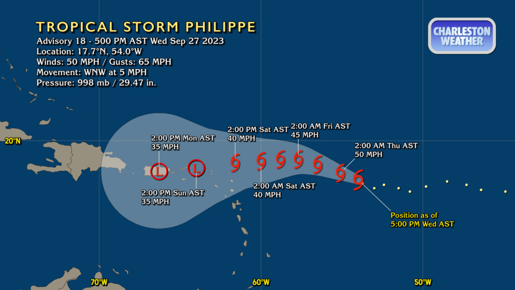
Philippe got a little stronger today, but this appears to be relatively short-lived as shear continues to work on the system. The expectation remains that Philippe will enter even more hostile conditions heading into the weekend and continue to exhibit an overall weakening trend. It should degenerate into a post-tropical low over the weekend as it heads toward Puerto Rico.
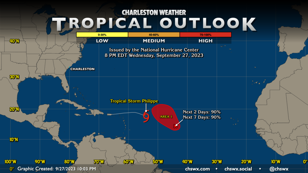
Meanwhile, Invest 91L has not quite gotten it together just yet, but the expectation remains that it will develop into a tropical depression over the next day or two. If and when it is named, it would likely get the name Rina (provided nothing else sprouts up to steal the name first). There are no other areas of interest that NHC is keeping an eye on right now, and there are no current threats to the Lowcountry.
Follow my Charleston Weather updates on Mastodon, Bluesky, Instagram, Facebook, or directly in a feed reader. Do you like what you see here? Please consider supporting my independent, hype-averse weather journalism and become a supporter on Patreon for a broader look at all things #chswx!