The week ahead: Mostly quiet and seasonably warm
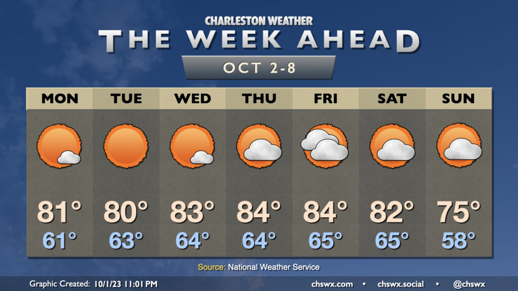
A blocking pattern aloft will keep our weather relatively quiet for much of the week before a front approaches heading into the weekend, which might deliver the first real shot of fall weather to the area for early next week.
Cloud cover will generally be sparse through Wednesday as high pressure remains firmly in control across the area. Our mornings will generally start in the low to mid-60s with highs topping out in the low 80s each afternoon with plenty of sunshine to be had. Cloud cover begins to tick up a bit for Thursday into Friday as the aforementioned front begins to approach the area. It remains to be seen just how much moisture moves back into the area; for now, the forecast remains rain-free, though it wouldn’t shock me to see some shower or thunderstorm chances added as we head into Friday. Saturday should feature decreasing clouds, and then it looks like a reinforcing shot of cooler air moves in for Sunday that could knock temperatures well below normal for this point in the year. We aren’t into sweater weather yet, but we’re making progress!
Coastal flooding remains a concern for much of the week
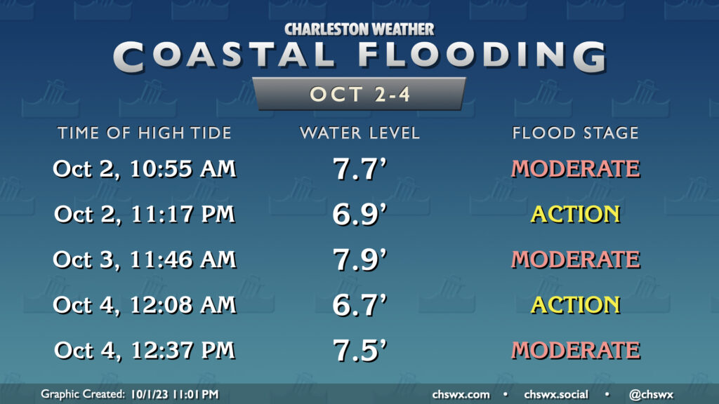
Moderate coastal flooding will remain a concern with the morning/early afternoon high tides through at least Wednesday, with minor coastal flooding probably a safe bet into Friday, as northeasterly winds continue to drive tidal departures fairly high despite the waning influence of the recent full moon at perigee. These tides could once again be disruptive to travel, particularly near the lunch hour, so be ready to route around flooded roads if you’re going to take advantage of the nice weather and enjoy some lunch downtown.
Tropics: Rina loses tropical characteristics, Philippe on its way to hurricane status
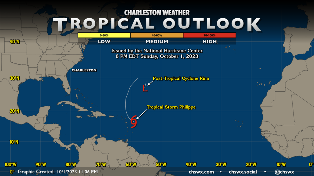
Rina has ceded the Atlantic basin to Philippe as it degenerated into a post-tropical cyclone Sunday evening, which brings NHC advisories to an end on the system, as it succumbed to shear. Philippe, on the other hand, could bring some wind and rain to Antigua and Barbuda, where tropical storm watches are in effect, before it lifts away as the week goes on. It’s expected to turn north and then northeastward, perhaps reaching hurricane strength as it does so, but should not affect any land areas beyond Monday. Elsewhere, NHC has no areas of interest in the Atlantic, and there are no current foreseeable tropical threats to the Lowcountry.
Follow my Charleston Weather updates on Mastodon, Bluesky, Instagram, Facebook, or directly in a feed reader. Do you like what you see here? Please consider supporting my independent, hype-averse weather journalism and become a supporter on Patreon for a broader look at all things #chswx!