Friday & the weekend: A shot of fall is incoming

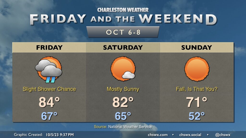
Well, I think we all know what the big weather story will be heading into Friday and the weekend — a really solid shot of cooler and drier air that arrives Sunday for the season’s first true taste of fall. To get there, we’ve got to get through a frontal passage, though limited moisture will keep shower and storm chances relatively low on Friday. Highs top out in the mid-80s after starting in the upper 60s, which is on the mild side of normal for this point in the year. Drier air begins to punch into the area on Saturday, though the cooler air will lag a little bit. Expect Saturday to be a pleasant day, though, with highs topping out in the low 80s in the early afternoon before the cooler air begins to do its thing.
We’ll wake up Sunday in the low 50s, which will be the coolest low since we started May 4th at 48°. Brilliantly sunny skies will aid temperatures getting into the low 70s in the afternoon. It should be a really beautiful day to get out and do stuff. You may very well need a light jacket or hoodie, even. And while this shot of “chilly” air will be somewhat short-lived — we warm back to the 80s by Tuesday — it’s a sign of what’s to come as we get deeper into October and fall.
Programming note
You probably noticed there was no weather post nor a podcast last night. Well, I’ve been a little under the weather (though, technically, aren’t we all?) and it’s kicked me straight in the hind rear, shredding my voice in the process. The podcast will be on hiatus again tonight/Friday, but I expect to get back into the swing of things by the weekend. Thanks for your patience as I recover.