Rest of the work week: Chilly start Wednesday, but trending warmer
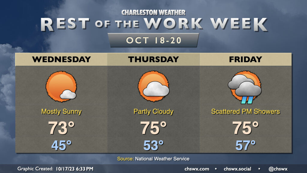
Sun continues for a couple more days before unsettled weather arrives later Friday with a cold front. Wednesday could be the chilliest start since April 18 if the NWS forecast verifies, with low to mid-40s common away from the locally warmer coastline. Temperatures will warm into the low 70s under mostly sunny skies, a couple clicks warmer than was observed on Tuesday.
Thursday runs even a little warmer as winds go a little more east to southeast, allowing some more moisture to work into the area. Expect to start Thursday in the low 50s before warming to the mid-70s under generally partly cloudy skies.
Our next rain chance arrives Friday afternoon into the evening ahead of a cold front. This will be the warmest overall day of the set as lows generally start in the mid-to-upper 50s before reaching highs in the mid-70s in the afternoon before showers begin. Right now, it doesn’t look like we’ll get much in the way of rain; generally around a quarter-inch at most. Of course, that doesn’t preclude a few spots from seeing some slightly heavier or lighter amounts.
Once the front is through, we have an excellent, seasonable weekend of weather on tap with lows in the low 50s and highs in the low 70s each afternoon with plenty of sunshine.