Tuesday’s forecast: Another seasonably cool day
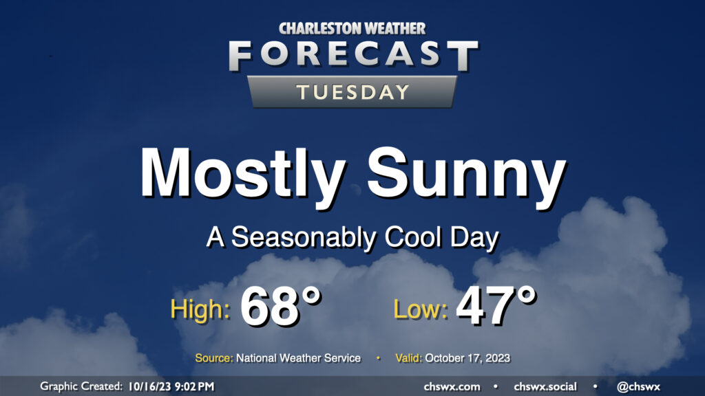
Tuesday will be another seasonably cool day under mostly sunny skies as high pressure remains in control at the surface with troughing aloft. After an upper-level disturbance passes by overnight Monday, skies will clear, allowing temperatures to fall into the upper 40s away from the coast for Tuesday morning. Temperatures then rise into the upper 60s, with the potential for a couple spots to hit 70°. Overall, a very seasonable October day across the Lowcountry.
Rest of the work week: Turning a little warmer, next rain Friday
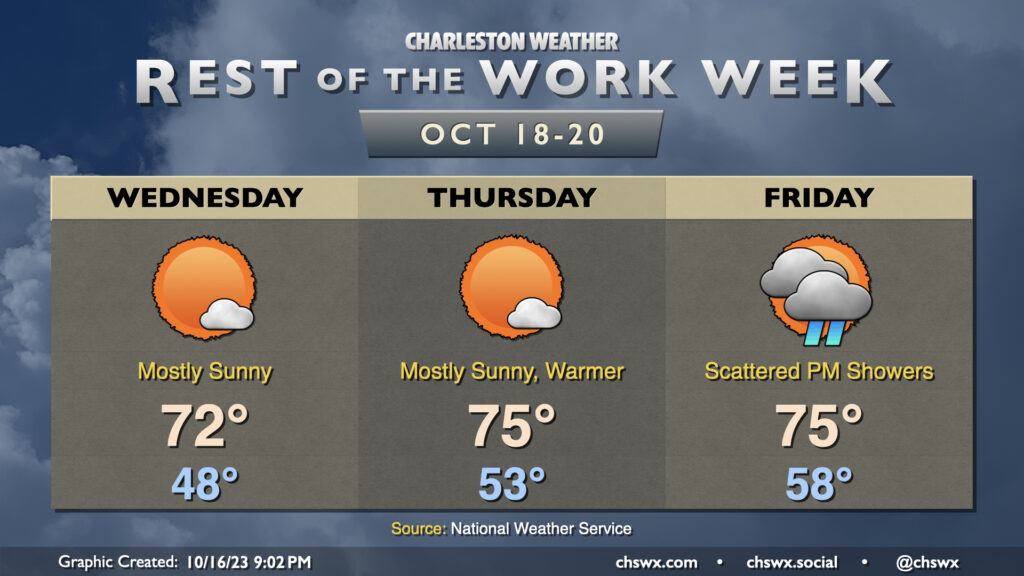
We start Wednesday back in the upper 40s before warming to the low 70s in the afternoon under mostly sunny skies as temperatures begin to moderate thanks to the trough aloft flattening out. Thursday will run even a few degrees warmer as partly cloudy to mostly sunny skies persist for one more day. From there, surface low pressure looks to spin up nearby as a cold front approaches from the west. We should see some scattered showers fire up in the afternoon and evening, but nothing totally crazy (and we can use some rain, anyway). This will lead to a really nice-looking weekend with low to mid-70s highs and plenty of sunshine.
Follow my Charleston Weather updates on Mastodon, Bluesky, Instagram, Facebook, or directly in a feed reader. Do you like what you see here? Please consider supporting my independent, hype-averse weather journalism and become a supporter on Patreon for a broader look at all things #chswx!