Friday & the weekend: Stormy close to the work week, then beauty

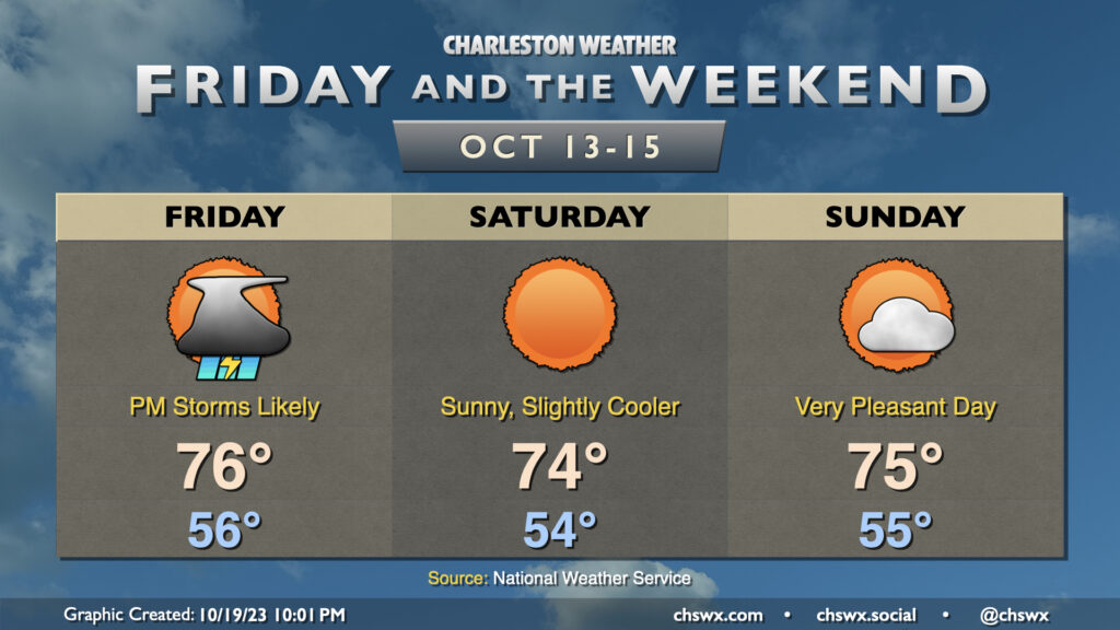
Showers and a few thunderstorms re-enter the weather picture for Friday as a cold front moves by, but it’ll be worth it as we have a gorgeous weekend ahead.
We start Friday in the mid-50s with dewpoints steadily rising throughout the day. Showers and thunderstorms will approach the area from the west as the day goes on, with storms possible perhaps as early as 1-2 PM, but most likely in the late afternoon to early evening hours. A storm or two could even be on the strong side, with damaging wind gusts the main concern. Rainfall between a quarter and half-inch is generally expected, with some spots under- and over-performing as is common with these kinds of convective setups. Due to the ongoing dry conditions, though, flooding is not expected to be an issue.
From there, the weekend looks great. Skies clear nicely for Saturday, and northwesterly flow will yield a rather beautiful day with lows in the mid-50s yielding to highs in the mid-70s in the afternoon with nary a cloud to be found. Sunday will be another really nice day with temperatures generally similar to Saturday’s, though we’ll see a bit more in the way of scattered clouds ahead of a dry frontal passage late. All in all, it looks to be a fantastic weekend to get out and do stuff.
Tropics: Tracking Tammy

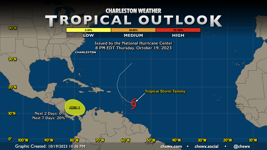
Tropical Storm Tammy has the floor right now in the Atlantic basin as it heads toward the Leeward Islands, where tropical storm warnings and hurricane watches are in effect. Tammy is forecast to become a hurricane over the weekend as it affects Saint Kitts and Antigua, gradually turning more northwest and then northward over time. From there, Tammy — likely as a hurricane — will turn northeastward and stay well away from much in the way of other land. It represents no threat to us here at home.
Additionally, NHC is keeping an eye on an area in the southern Caribbean near Nicaragua and Costa Rica for possible development heading into next week, but right now it’s a very slim chance at 20% over the next seven days. Guidance doesn’t seem to do much with this area right now; we’ll keep an eye on it in case that changes.
Follow my Charleston Weather updates on Mastodon, Bluesky, Instagram, Facebook, or directly in a feed reader. Do you like what you see here? Please consider supporting my independent, hype-averse weather journalism and become a supporter on Patreon for a broader look at all things #chswx!