Tuesday: Cold front arrives with increasing clouds and maybe a shower
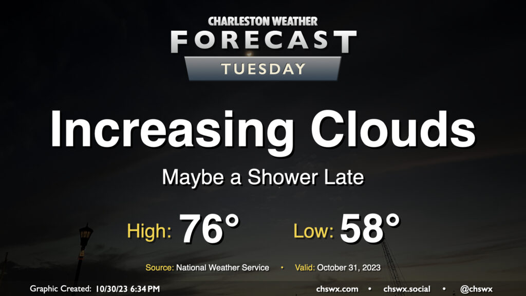
Changes are on the way on Halloween as a strong cold front moves across the area later in the day, bringing an uptick in cloud cover, maybe a shower or two, and a surge of the coldest air so far this season to start November. We start Tuesday in the upper 50s to around 60° with just a few clouds to start. From there, expect cloud cover to gradually thicken as the front gets closer. We should see it get through sometime mid-afternoon into the early evening; you’ll notice it when winds shift around more to the north.
Trick-or-treaters will want a light jacket as temperatures cool into the 50s throughout the evening. As mentioned, a shower or two will be possible, but the risk is quite low.
Coastal flooding issues continue with mid-morning high tides
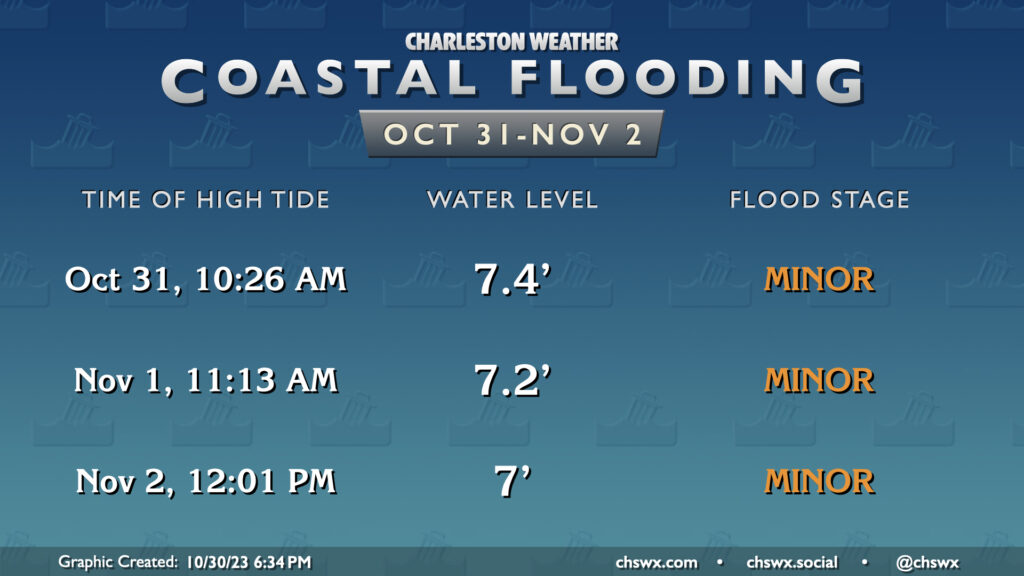
We will continue to contend with coastal flooding during the mid-morning and midday high tides for the rest of the week. Water levels should top out near moderate flood stage with the 10:26 AM high tide on Tuesday, which could close a couple roads. Tides will continue to trend down as astronomical influences from the recent full moon fade, but we should see salt water flooding concerns with Wednesday and, to a lesser extent, Thursday’s midday high tides as well. Stay alert for possible Coastal Flood Advisories.
Rest of the work week: Chilliest weather of the season, but relenting for the weekend
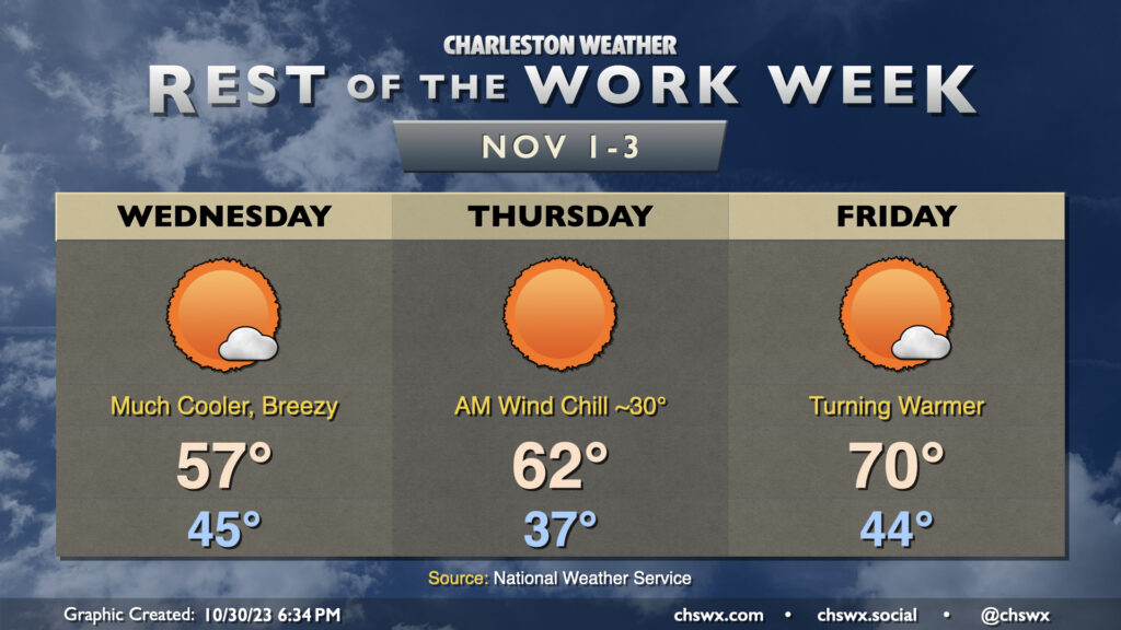
Wednesday is going to feel a lot different than recent days. We’ll start the day in the mid-40s, but brisk northerly winds will make it feel closer to the upper 30s. Highs on Wednesday will struggle to the mid-to-upper 50s despite almost full sunshine. The combination of the drier air, gusty winds, and a few weeks without appreciable rain could increase the risk for fire as well.
Thursday will feature the coldest start of the week. Expect mid-to-upper 30s across the area away from the coast, and with continued breezy winds out of the north, wind chills will drive down to around 30°. The lack of moisture precludes any frost issues. Thursday’s high will run a little bit warmer, though, with low 60s as opposed to Wednesday’s upper 50s. The warming trend continues into Friday and the weekend, sending us back to the 70s in the afternoon with morning lows warming back into the mid-40s and low 50s.
Follow my Charleston Weather updates on Mastodon, Bluesky, Instagram, Facebook, or directly in a feed reader. Do you like what you see here? Please consider supporting my independent, hype-averse weather journalism and become a supporter on Patreon for a broader look at all things #chswx!