Thursday’s forecast: Coldest start since March; freeze warnings well inland

Thursday gets off to the coldest start since March with lows expected in the mid-30s across much of the metro area. Further inland and in more sheltered locations, it’s quite possible that we’re going to see temperatures fall below freezing. A Freeze Warning is in effect for inland Berkeley and Dorchester for Thursday morning; be sure you’re protecting plants and pets. Add in winds around 5-10 MPH, and we’re talking wind chills in the 20s in many spots. Dress appropriately as you head out tomorrow morning!
From there, temperatures will head to the low 60s in the afternoon despite mostly sunny skies. It’ll ultimately be yet another sweater-worthy day across the area with a continued north to northeasterly breeze.
Friday & the weekend: Back to the 70s
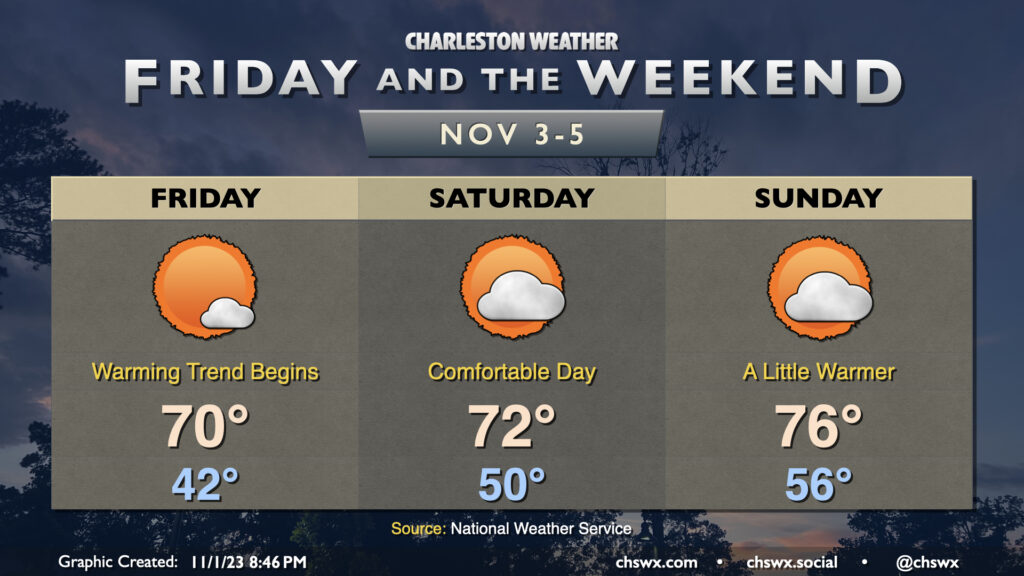
The chill will subside as we head into Friday and the weekend. We start Friday in the low 40s, but warm to around 70° in the afternoon under mostly sunny skies. A few more clouds work their way into the picture for the weekend, but the warming trend continues and there’s still going to be plenty of sunshine to be had. Expect highs in the low 70s on Saturday and the mid-70s on Sunday after starts in the low-to-mid-50s. Temperatures look to remain generally above normal heading into the first part of next week, too.
Looking for rain? The next mentionable chance appears to arrive Tuesday as a front approaches, but it’s not a terribly high chance of rain right now, either.
Follow my Charleston Weather updates on Mastodon, Bluesky, Instagram, Facebook, or directly in a feed reader. Do you like what you see here? Please consider supporting my independent, hype-averse weather journalism and become a supporter on Patreon for a broader look at all things #chswx!