Friday & the weekend: Frosty start for some, but turning warmer

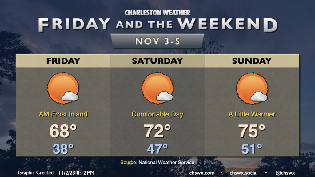
We’ll get Friday off to a slightly frosty start in some parts away from the coast as lows dip into the 30s once again with a little bit more moisture to work with and a little less in the way of wind (though wind chills could still dip into the low 30s). A Frost Advisory is in effect for inland Berkeley and Dorchester for Friday morning where the risk for frost will be greatest, so ensure you’ve got sensitive plants covered just in case. From there, though, we’ll warm into the upper 60s in the afternoon (and 70° might not be totally out of the question, either) under mostly sunny skies.
The warming trend continues Saturday. We start the day in the mid-to-upper-40s — almost ten degrees warmer than Friday. Highs should get into the low 70s under mostly sunny skies — a very nice day to get outside, it looks like.
We turn even a little warmer for Sunday. Expect Sunday to start out around 50-51° or so, warming to the mid-70s in the afternoon. A few clouds will dot the skies from time to time, but it’ll be another day of brilliant sunshine.
We’ll be getting that sunshine in an hour earlier than Saturday, though, as Daylight Saving Time ends at 2am Sunday, sending us back into Eastern Standard Time (UTC-5). The sun will rise around 6:40am, but will set just shy of 5:30pm. Be sure to set clocks needing manual changes back an hour Saturday night. It’s a good time to change batteries in your weather radios and smoke detectors as well.