The week ahead: Mostly quiet; first freeze possible mid-week
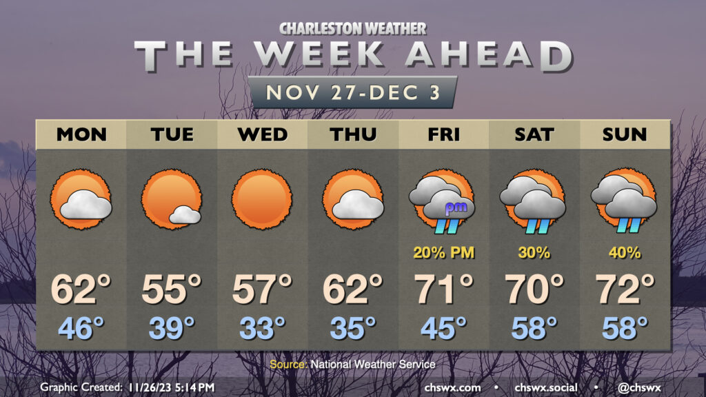
After a very chilly and raw Sunday in which the high temperature didn’t (as of this writing, anyway) reach 50°, temperatures make a brief rebound for Monday in the wake of a front as high pressure builds in. Diminishing cloud cover and northwesterly winds will help temperatures rebound to the low 60s on Monday, which will feel positively wonderful. Temperatures will then drop into the upper 30s for Tuesday morning as the cooler high pressure begins to settle in over the area. Temperatures will only reach the mid-50s on Tuesday despite ample sunshine. Radiational cooling conditions improve tremendously as winds go light and skies go clear Tuesday night into Wednesday morning, and this will allow temperatures to get down to freezing for the first time this season in many spots in the metro, particularly inland. Highs will head to the mid-50s once again with full sunshine.
From there, high pressure begins to move away, turning nature’s heat pump back on as winds go more southerly. We’ll get off to another frosty start Thursday morning before warming to the low 60s in the afternoon. Friday will be even warmer, with lows in the mid-40s (closer to normal for this point in the year) and highs in the low 70s in the afternoon. We’ll keep this warmer weather going into the weekend, with lows well above normal for Saturday and Sunday, albeit with some shower chances as mid-level disturbances swing through from time to time.