Friday: Warming trend continues
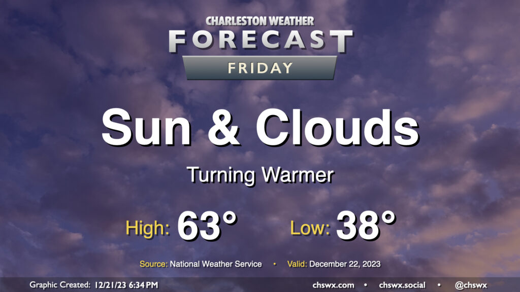
A warming trend continues for Friday as we head into Christmas weekend. We’ll get off to a warmer start — though it’ll still be in the mid-to-upper 30s — than we did on Thursday, which dipped back into the upper 20s. Temperatures Friday afternoon should once again head to the low-to-mid-60s with a mix of sunshine and high cloud cover as high pressure continues to be the main weather feature at the surface and aloft.
Christmas weekend: It’s beginning to not really feel a lot like Christmas
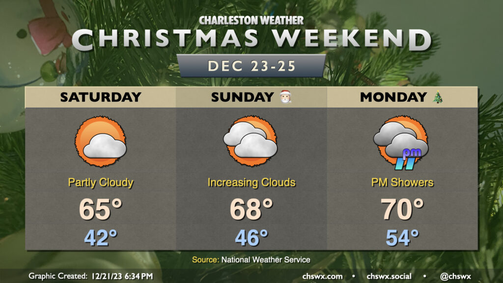
Temperatures will continue to warm through the weekend into Christmas Day as high pressure ridging aloft sticks around and we start to see high pressure lose its grip ahead of a storm system. Saturday will start in the low to mid-40s before warming to the mid-60s in the afternoon under partly cloudy skies. Expect similar conditions for Sunday, with temperatures running even a few degrees warmer. We should see a slight uptick in cloud cover as we head into the afternoon and evening hours Sunday, but the rain holds off until Christmas Day, with rain chances generally ticking up in the afternoon and evening hours. Christmas Day looks to mark the peak of the warming trend, as highs should reach or maybe even head a little over 70° in the afternoon after starting in the mid-50s. Unsettled weather continues into Tuesday, when a few storms may be possible, before a gradual trend downward in rain chances for the middle of next week.
Follow my Charleston Weather updates on Mastodon, Bluesky, Instagram, Facebook, or directly in a feed reader. Do you like what you see here? Please consider supporting my independent, hype-averse weather journalism and become a supporter on Patreon for a broader look at all things #chswx!