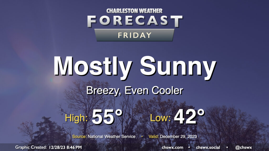
Friday & New Year’s weekend: Generally cool and quiet, though a bit breezy at times

A cold front coming through overnight will send temperatures even cooler for Friday. We start the day in the low 40s, but cold air will be blowing in throughout the day. This will keep temperatures suppressed to about the mid-50s in the afternoon despite mostly sunny skies. It’ll be a breezy day, too; winds will generally run 10-15 MPH with gusts to 25 MPH as daytime heating helps push mixing heights to about 5,000 feet. Cloud cover will generally be sparse with a fairly dry atmosphere in place, with maybe a few fair weather cumulus showing up from time to time.
New Year’s weekend: Still cool, still quiet

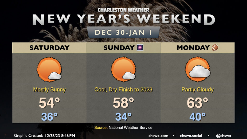
Quiet and generally cool weather continues as we finish up 2023 and head into 2024. Saturday will be another mostly sunny and breezy day; we’ll start in the mid-30s, but the wind may make it feel like it’s below freezing. Temperatures will once again only warm to about the mid-50s as the freezing level remains around 3,000 feet with the core of the coldest air working its way through. Mostly sunny skies are again expected, with fair-weather cumulus again the main culprit.
A warming trend begins on Sunday as the colder air departs. We start Sunday in the mid-30s once more, but with some subtle ridging getting into place, surface temperatures will be able to warm a little more into the upper 50s. It wouldn’t shock me if a couple spots touched 60°. It’ll be another mostly sunny day with any cloud cover likely coming in the form of higher clouds this go-around as thermal profiles on model soundings are quite stable in the lower troposphere, with a pronounced warm nose around 5,000 feet that will put the kibosh on any fair-weather cumulus development. There won’t be any weather concerns for New Year’s revelry Sunday night, though you will want a jacket as temperatures fall into the mid-40s around midnight.
The warming trend continues into 2024, at least briefly. Expect highs to top out in the low 60s on New Year’s Day after starting around 40°. Cloud cover will be ticking up a bit ahead of a cold front that’ll arrive later Monday into Tuesday, which might bring about a few showers as it passes by.
Follow my Charleston Weather updates on Mastodon, Bluesky, Instagram, Facebook, or directly in a feed reader. Do you like what you see here? Please consider supporting my independent, hype-averse weather journalism and become a supporter on Patreon for a broader look at all things #chswx!