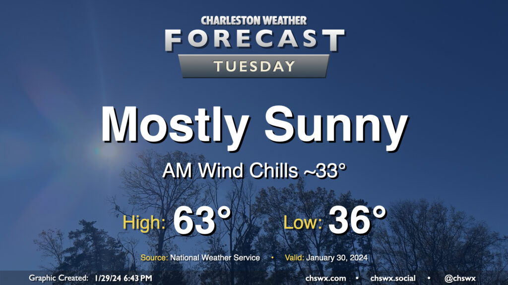
Tuesday: Quiet and seasonable conditions

Expect another seasonally-appropriate day on Tuesday, though we will start out a little cooler than we did on Monday. Lows should bottom out in the mid-30s, and with a little wind still blowing, it’ll feel a few degrees cooler. Temperatures should head to the low-to-mid-60s under mostly sunny skies. Winds will shift southerly and pick up a bit in the afternoon ahead of a weak low, nudging dewpoints up a few degrees but certainly nothing outrageous.
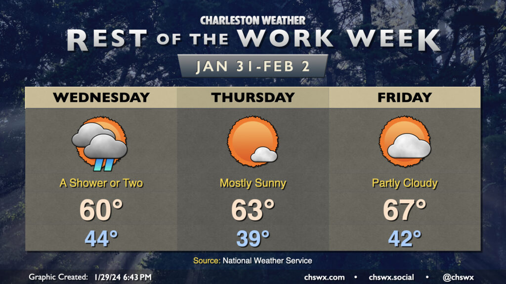
Rest of the work week: A few showers possible early Wednesday, then quieting down

A few showers will be possible on Wednesday as a weak frontal system instigated by an upper low moves by. We’ll start the day in the mid-40s with mostly cloudy skies before some post-frontal clearing starts to take place later in the day. Winds will go around to the northwest and the resulting influx of cooler air will keep highs around 60°.
Quiet weather resumes for Thursday as high pressure takes back over for a few days. Expect a mostly sunny day generally in spitting distance of February 1 normal temperatures on Thursday. Friday is Groundhog Day, and if we end up being caught up in a temporal loop as a result, it will at least be a nice weather day: expect partly cloudy skies with lows in the low 40s yielding to highs in the mid-60s in the afternoon.
Rain-free conditions should continue until Sunday before low pressure strafing the Gulf Coast helps drive moisture back into the area for a couple days. Temperatures will run at or above normal.
Follow my Charleston Weather updates on Mastodon, Bluesky, Instagram, Facebook, or directly in a feed reader. Do you like what you see here? Please consider supporting my independent, hype-averse weather journalism and become a supporter on Patreon for a broader look at all things #chswx!