Rest of the work week: A warm Wednesday, then temperatures crash
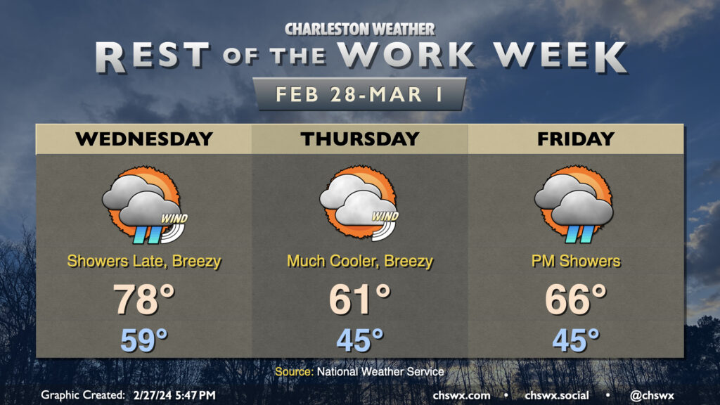
Unseasonable warmth continues for one more day before it is blunted by a sharp cold front that will bring a few late showers Wednesday followed by much cooler weather on Thursday.
First, though, we start Wednesday with low temperatures approaching 60°, warming to the upper 70s to maybe even 80° in the afternoon ahead of the aforementioned front. It’ll be breezy, too, as the pressure gradient tightens ahead of the front. We should stay rain-free through the daylight hours; from there, a thin line of showers, which has been depicted on models for the past several days, should move by and produce a little rain, but nothing too impactful.
The impacts from the front will come in the form of a sharp cooldown for Leap Day. We start Thursday in the mid-40s, only warming to the low 60s in the afternoon with more clouds than not and breezy northeasterly winds. Winds will slacken a little bit Thursday night into early Friday, though low pressure developing offshore as high pressure wedges southwestward into the area should help to tighten the gradient a bit more as we go through Friday. Shower chances increase throughout the day Friday as moisture overruns the wedge and the aforementioned low pressure develops, with rain chances peaking Friday night into Saturday morning. Temperatures are currently forecast in the mid-60s, but downward revisions to that forecast certainly seem possible as we learn more about the strength of the wedge.