Tuesday: Turning even warmer
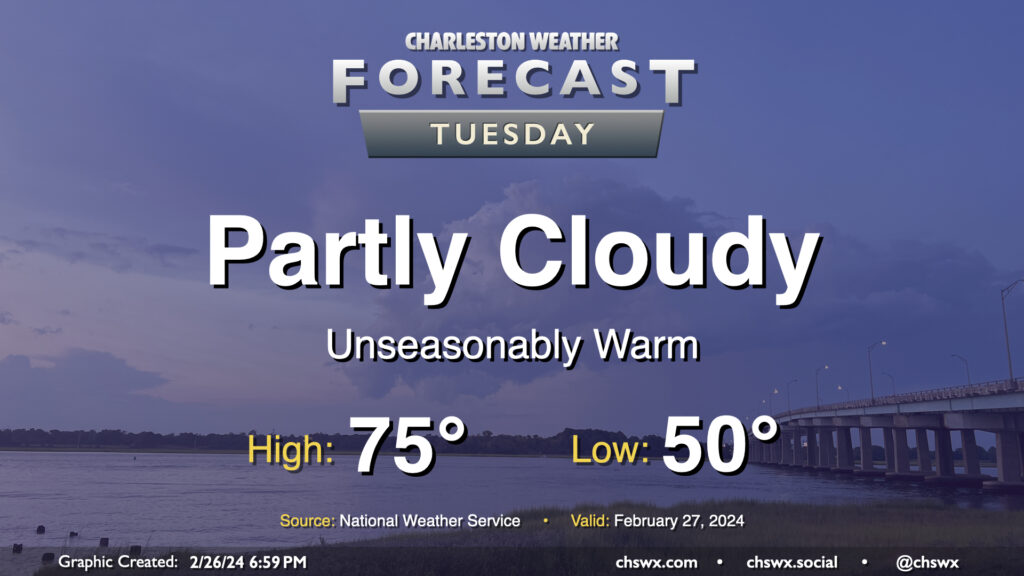
We turn even warmer on Tuesday as high pressure moves further offshore and more warmer air is drawn northward. Temperatures start several degrees above normal, generally in the low 50s (and even warmer closer to the coast). From there, we’ll head well into the mid-70s in the afternoon despite an uptick in cloud cover compared to Monday as a disturbance moves by to the north. We’ll stay out of the rain, though. Winds will run a little on the breezy side as well, but nothing too crazy.
Rest of the work week: All aboard the wild temperature ride
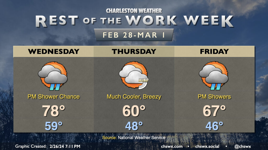
The early-week warmth peaks Wednesday ahead of a cold front. Temperatures on Wednesday start roughly 15° warmer than normal as temperatures get close to 80° in the afternoon away from the much cooler coastline. A diminishing line of showers should move by Wednesday evening, marking the front’s passage. We’ll sure feel it on Thursday; lows will run a full ten degrees below where they did Wednesday, and breezy northeast winds with broken cloud cover will keep highs just to around 60°. Friday’s forecast remains somewhat unclear, but for now, plan for another day in the mid-60s with some showers, particularly in the afternoon into the evening, as a trough or low pressure center sets up offshore.
Follow my Charleston Weather updates on Mastodon, Bluesky, Instagram, Facebook, or directly in a feed reader. Do you like what you see here? Please consider supporting my independent, hype-averse weather journalism and become a supporter on Patreon for a broader look at all things #chswx!