Tuesday’s forecast: Getting springier
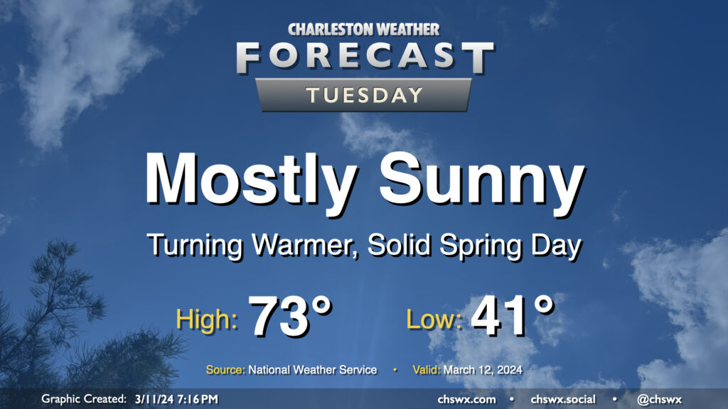
After one more somewhat chilly night — expect low 40s across much of the metro, with mid-to-upper 30s possible further inland — we start a warming trend that’ll get us into the 80s by the end of the week. Tuesday looks rather delightful: expect highs to top out in the low 70s away from the locally cooler coastline. Comfortably dry air will be in place with relative humidity bottoming out around 30% in the afternoon, and we’ll keep a solid amount of sunshine throughout the day. Winds will start to swing more southwesterly in the afternoon and kick up to around 5-10 MPH. Not bad!
Rest of the work week: 80s return
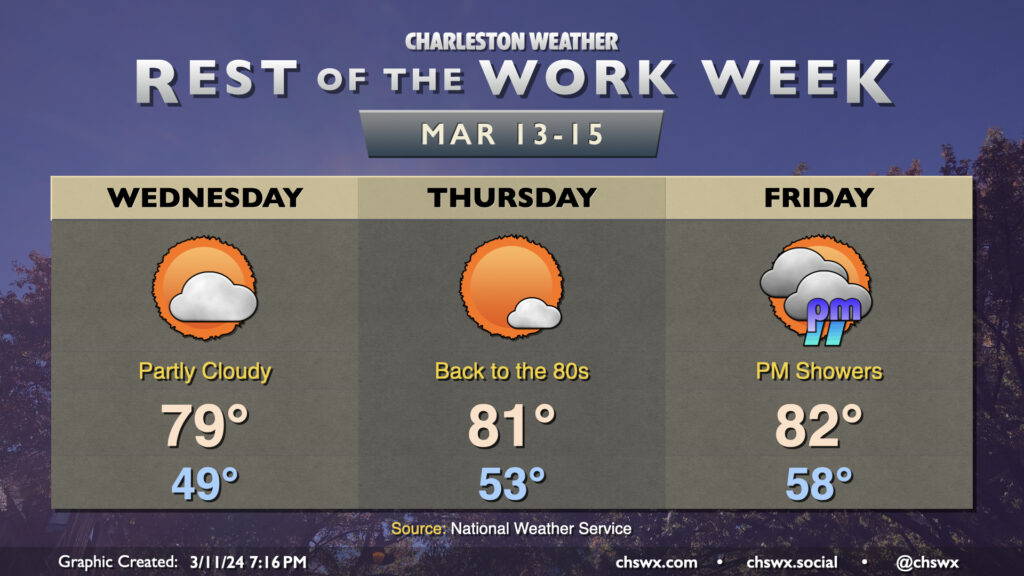
We’ll keep getting warmer as the week goes on as ridging at the surface and aloft remain the primary weather drivers through Thursday. A weak disturbance could kick up a few more clouds on Wednesday, but it’ll be quite dry near the surface, so no rain is expected. Wednesday will top out in the upper 70s to around 80°, but we should get beyond the 80° threshold on Thursday afternoon. Rain-free weather should continue through Friday morning, but as the next storm system draws closer and ridging aloft breaks down, a risk for showers and maybe a thunderstorm re-enters the forecast picture later Friday afternoon into the evening. We keep shower and storm chances — along with warmer-than-normal temperatures — going through the St. Patrick’s weekend, too.
Follow my Charleston Weather updates on Mastodon, Bluesky, Instagram, Facebook, or directly in a feed reader. Do you like what you see here? Please consider supporting my independent, hype-averse weather journalism and become a supporter on Patreon for a broader look at all things #chswx!