Rest of the work week: Late April warmth in mid-March

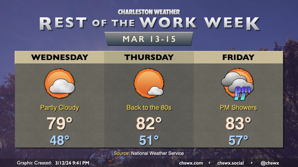
The rest of the work week will be much warmer than mid-March normals as high pressure ridges across the area at the surface and aloft. Temperatures on Wednesday will start in the upper 40s, warming to near 80° in the afternoon under partly cloudy skies as a weak disturbance ripples across the area, bringing only an uptick in cloud cover and little else given such a dry atmosphere at the surface. Thursday will see us solidly back in the 80s once again with just a cloud or two at times as high pressure will be strongest that day. We’ll start to see cloud cover come back up for Friday as high pressure gets shunted offshore by the next storm system, though it’ll still be a very warm day by mid-March standards as lows bottom out in the mid-50s with highs warming to the low 80s in the afternoon. We should get much of the day in rain-free, though a shower or two will be possible as we get into the late afternoon and evening hours.