Picture-perfect Thursday, but an unsettled weekend at times

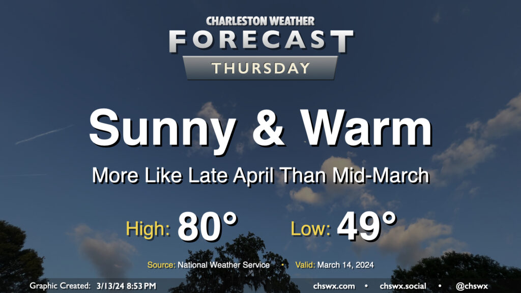
Thursday looks like an excellent weather day across the Lowcountry, something out of the late-April playbook but in mid-March. We’ll start the day around 50° once again, warming to the low 80s in the afternoon with maybe a few clouds amongst otherwise clear skies as ridging aloft strengthens briefly for the day. Expect winds generally in the 5-10 MPH range, picking up a little in the afternoon in the wake of a sea breeze. Enjoy!
Friday & the weekend: Periodically unsettled, but not a total rainout, either

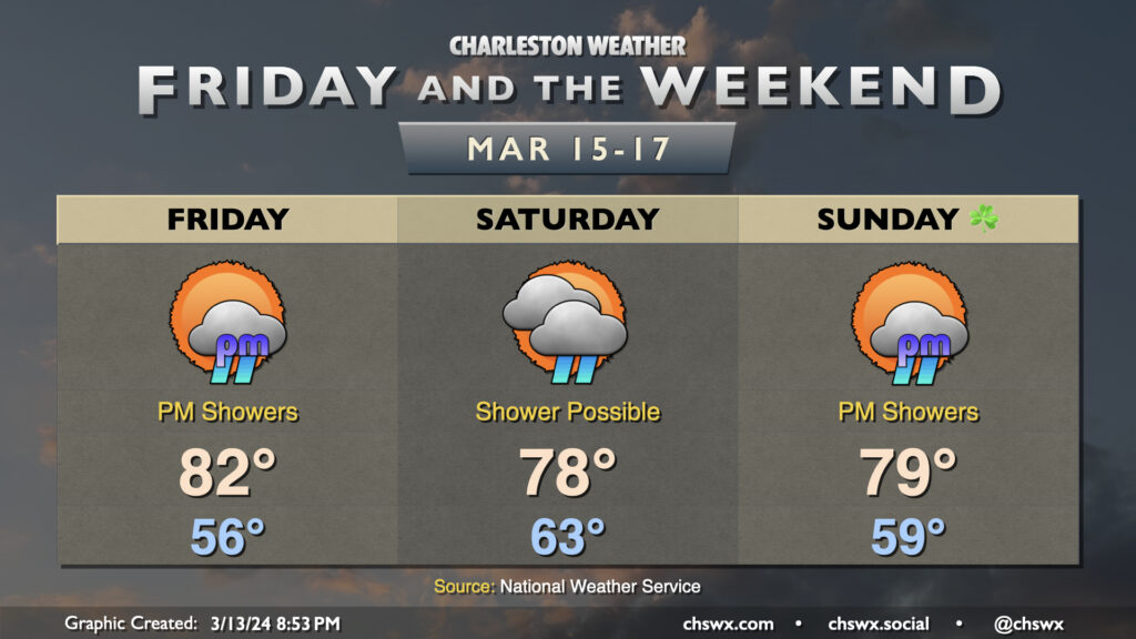
High pressure loses its grip on the area Friday, and we’ll start to see a more unsettled pattern take shape for the weekend. However, it won’t rain all day at any one location, either, and there will probably be plenty of rain-free time to be had, too. Our warm spell peaks Friday, with highs topping out well into the low 80s as southwest winds help a warmer and more moist airmass punch into the area ahead of a cold front. This front should bring some showers — some rumbles of thunder aren’t out of the question, either — later Friday afternoon through Saturday morning. Shower chances persist throughout the day Saturday as the front moves by, though they’ll generally be on the lower side. Temperatures Saturday will also end up a click or two cooler than Friday, but not by much.
Getting into St. Patrick’s Day, we should start off on a partly cloudy and still warmer-than-normal note as the front doesn’t do much to cool us off. We should stay rain-free for at least the first part of the day before shower chances return ahead of another storm system later Sunday. Temperatures top out near 80° Sunday afternoon ahead of any showers and storms.
Follow my Charleston Weather updates on Mastodon, Bluesky, Instagram, Facebook, or directly in a feed reader. Do you like what you see here? Please consider supporting my independent, hype-averse weather journalism and become a supporter on Patreon for a broader look at all things #chswx!