Tuesday’s forecast: Cooler temperatures just in time to start astronomical Spring
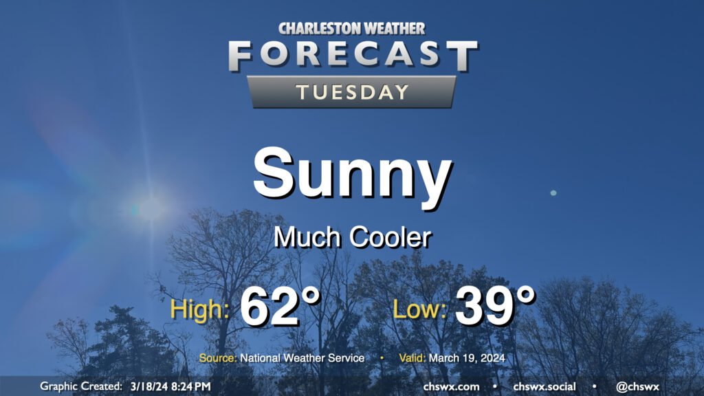
After the past couple weeks of warmth, Tuesday might come as a bit of a shock as lows dip into the upper 30s across a good bit of the metro to start the day as cool high pressure builds in throughout the day. Temperatures will only get into the low 60s, far below normal for mid-March (the normal high for March 19 is 71°). At least the sun will be out, and the March sun angle should make these cooler-than-normal temperatures feel pretty decent.
Rest of the work week: Chill exits quickly, unsettled again for Friday
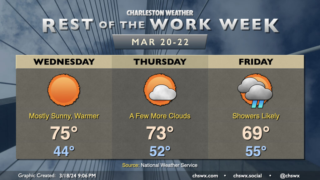
The upper trough responsible for Tuesday’s cooldown swings through rather quickly, though, and we will warm up beginning Wednesday, starting in the mid-40s and peaking in the mid-70s in the afternoon with another day of largely sunny skies courtesy of some downslope flow aloft. A dry front comes by overnight Wednesday into Thursday, stalling out to our south, but this will only act to bring a little more cloud cover and slightly cooler temperatures. Said front lifts back north as a warm front as low pressure develops and moves across the area for Friday and the weekend. Right now, the best chances of rain with this system look to be around midday Friday through Saturday morning, but timing is still up in the air thanks to model discrepancies. Highs dip back down into the 60s with the rain on Friday, and we’ll stay around mid-late March normals thereafter.
Follow my Charleston Weather updates on Mastodon, Bluesky, Instagram, Facebook, or directly in a feed reader. Do you like what you see here? Please consider supporting my independent, hype-averse weather journalism and become a supporter on Patreon for a broader look at all things #chswx!