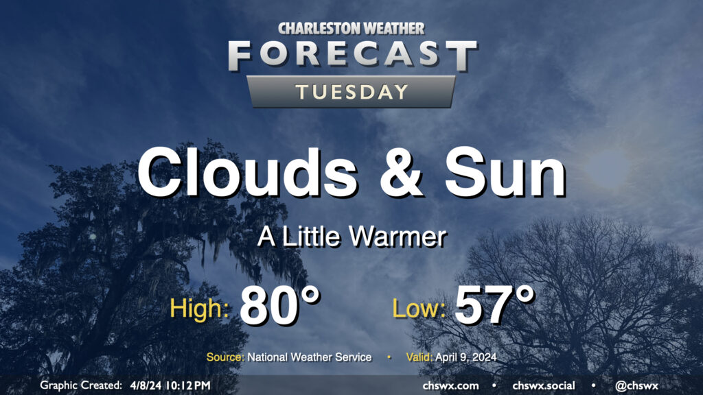
Tuesday’s forecast: A few more clouds, a little warmer

Tuesday will turn a little warmer as winds continue to blow southerly on the backside of high pressure. We start the day in the mid-50s, warming to around 80° in the afternoon as clouds mix in more prominently into the sky character. No rain, though we will likely see some evening coastal flooding once again with high tide around 9:34 PM thanks to the recent new moon and continued onshore flow.
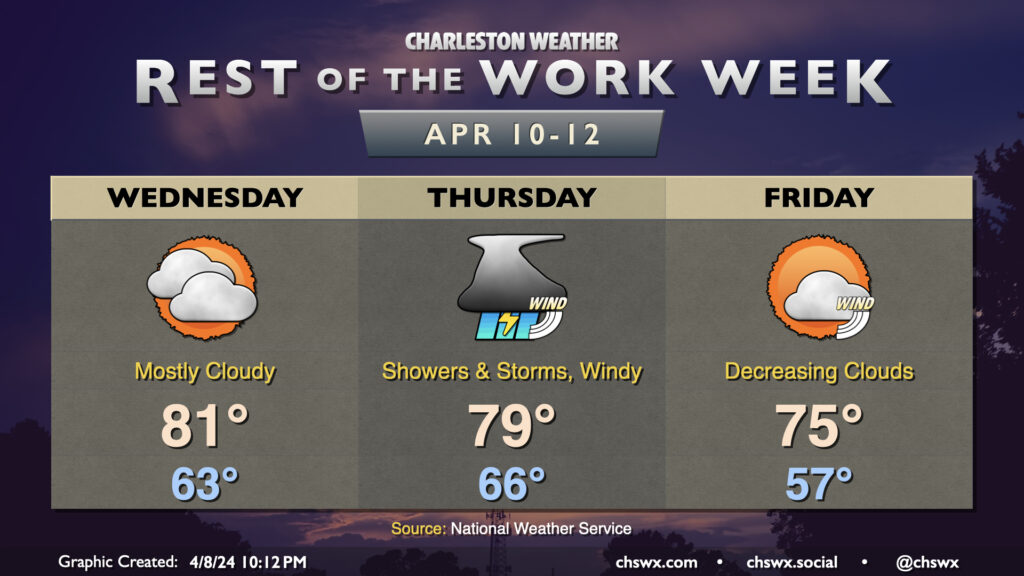
Rest of the work week: Active weather possible Thursday

A storm system will be the main weather-maker for the second half of the work week. Cloud cover will increase further on Wednesday as the system approaches the area. However, temperatures will also peak as warm air continues to pump into the area from the south. Expect a mild start in the low 60s to yield to highs in the low 80s in the afternoon.
Rain holds off until Thursday as the storm system moves through. A warm front lifts north early in the day, with fairly gusty southerly winds expected in its wake. Showers and thunderstorms should be along a line ahead of the cold front, moving through a fairly well-sheared warm sector and arriving in the Lowcountry by afternoon. We’ll see how much instability can develop, but if storms organize, some pockets of wind damage will be possible. Even outside of thunderstorms, gusts 30+ MPH appear to be a pretty good bet. Temperatures will be mild — expect to start in the mid-60s and warm to the upper 70s to around 80° in the afternoon.
The front clears the area early Friday, and we’ll see improving weather throughout the day. It’ll run cooler, too — expect to start in the mid-to-upper 50s with highs in the mid-70s under increasingly sunny skies. We’ll stay on the breezy side as cooler air moves into the area. Winds slacken for the weekend, though, which looks warm and sunny.
Programming note
I’m expecting to get back into the swing of the normal posting routine this week, with the podcast resuming Tuesday evening. Thanks to all of you for your well wishes and thoughts over the past few challenging weeks!
Follow my Charleston Weather updates on Mastodon, Bluesky, Instagram, Facebook, or directly in a feed reader. Do you like what you see here? Please consider supporting my independent, hype-averse weather journalism and become a supporter on Patreon for a broader look at all things #chswx!