Tuesday: Heating up

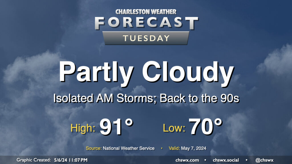
We may contend with a storm or two in the morning, but the weather story for Tuesday will be the return of the 90s in the afternoon. It’ll be a warm start with lows around 70°, but as the ridge aloft builds in, highs top out in the low 90s. If there’s one bit of good news here, it’s that it’s not summer-humid just yet, and dewpoints should run in the mid-60s, keeping heat indices reasonably in check. Cloud cover will be diminishing throughout the day as well, so expect plenty of sunshine as we get into the afternoon and evening hours.
Rest of the work week: Staying hot, then turning stormy

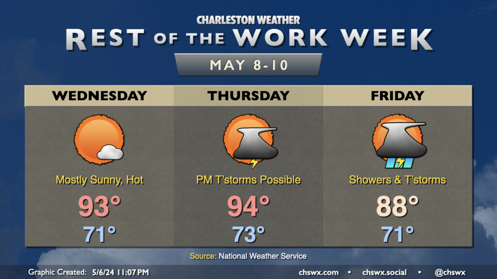
This hot stretch continues Wednesday and into Thursday, with record highs potentially in jeopardy both days as the hottest weather of the year so far arrives. Ridging aloft will keep skies mostly sunny on Wednesday, precluding much in the way of cloud formation much less any showers or storms to bring relief.

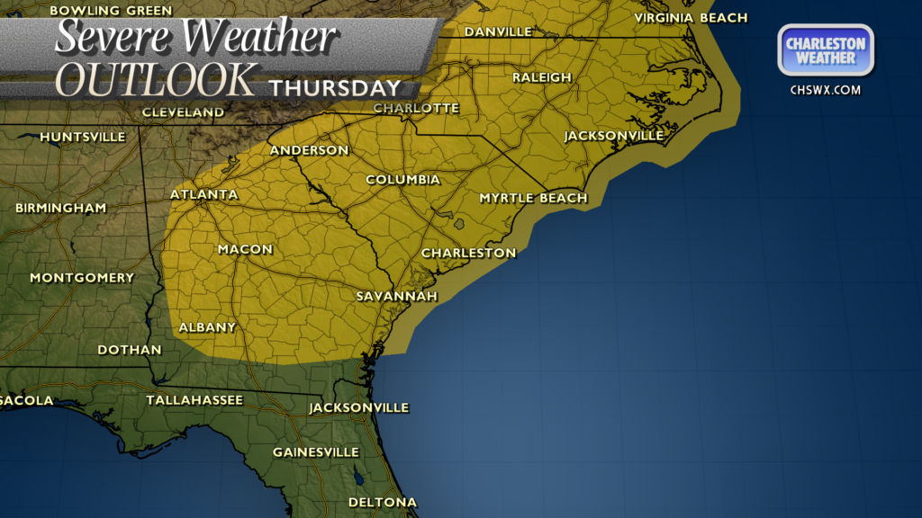
Thursday starts as one more hot day, but that ridging breaks down ahead of a disturbance that will push a cold front into the area Friday. Warm and unstable air with ample shear ahead of the disturbance will provide a couple ingredients for showers and storms to fire later in the day, perhaps making a run at the area as we get into Thursday evening. A few of these storms could turn strong to severe given the instability that’ll be in place, so stay tuned. The storm threat lingers into Friday as the cold front pushes through, with showers and thunderstorms possible throughout the day. We get a good payoff for the weekend, though, as cooler and drier air filters in, sending temperatures back to more pleasant mid-May normals just in time for Mother’s Day.
Follow my Charleston Weather updates on Mastodon, Bluesky, Instagram, Facebook, or directly in a feed reader. Do you like what you see here? Please consider supporting my independent, hype-averse weather journalism and become a supporter on Patreon for a broader look at all things #chswx!